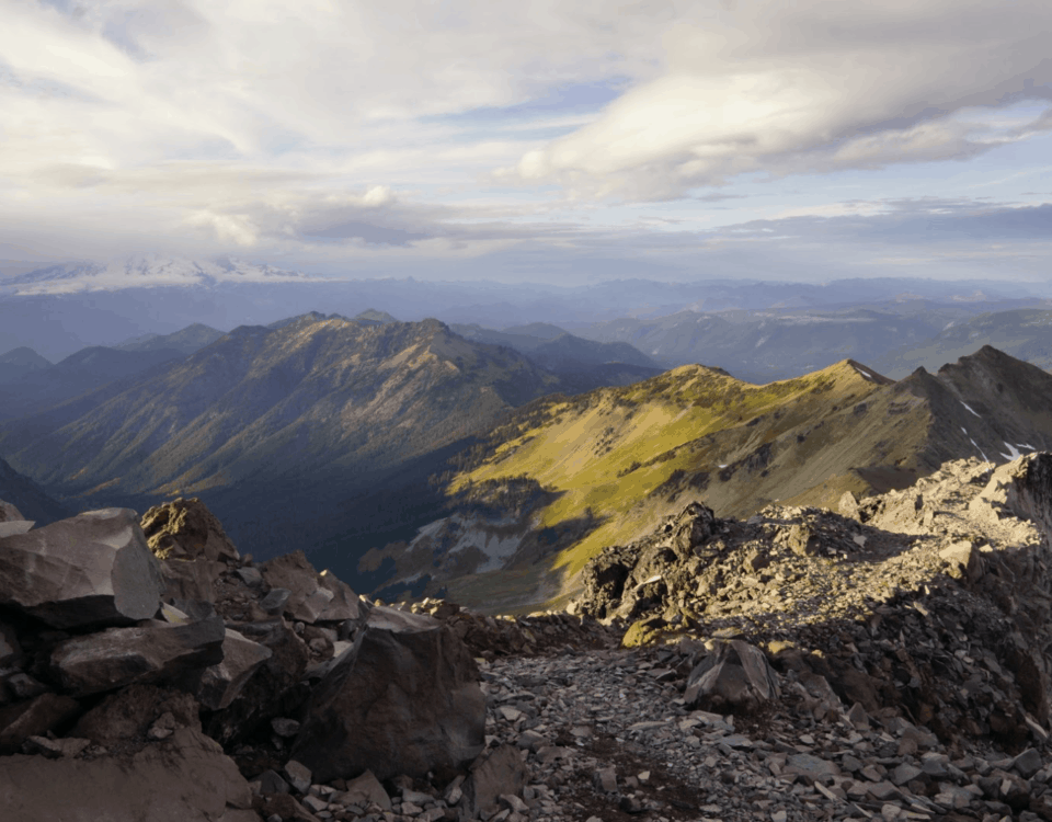
Over the hills and through the woods, across Oregon we go!

The Last Hurrah of California
August 23, 2016
Huckleberry Mushroom Delight – The Trail’s End
October 13, 2016Refreshed and resupplied, we left Ashland in good spirits, catching a ride with a friend back to Callahan’s Lodge where we returned to the trail. This in itself was something to laugh at, as we crammed nine hikers, gear and all, into the camper of an old V4 Toyota. Trying to get up to the drop off point by Mt. Ashland, we maxed out at 25mph, semi’s passing us on both sides. Eventually we arrived, and as we walked down the road towards the trail head, we were aggressively reminded by the eccentric locals that, “California is burning! Everything is on fire! Go down, not up! If you get caught in a fire, hug a redwood, its the only thing that survives!” Ready for the solitude of the trail, we began hiking shortly after, taking notice of the smokey skies to the South.
From here we hiked for a couple of days, taking us into Mazama village on the South side of Crater Lake. After hiking in Chaco sandals for the last 600 miles, my right ankle was becoming very sore, and we took a couple days here to let it heal. We enjoyed our time in the village as we were provided with a complementary place to camp (despite the campground being sold out for the season), hot showers, and a friendly general store. Here I also received my new pair of replacement boots from Lowa, free of charge. With ample ankle support, we hit the trail, opting for the alternate route that follows the West rim of Crater Lake. Though the skies were smokey from fires past and present, our view of the lake was still magnificent. Surprisingly, the surface area of this lake is only about 21 square miles (Lake Tahoe is 191) yet it is the deepest lake in North America, just shy of 2000ft. Unfortunately there is no camping along the rim of the lake, so we were forced to hike this section over the course of a day, taking in the caldera every chance we could.
After Crater Lake, we hiked through some long dry volcanic stretches, pushing higher miles in the interest of water. We hiked around Mt. Thielsen (Big Cowhorn), a very sharp and isolated peak, evidently a dormant volcano. From a distance, it loomed like the Matterhorn of Oregon. Around this time we passed over the Oregon/ Washington high point at 7570ft, a dramatic contrast to Forester’s pass in the high Sierra at 13,200ft. Afterwards, we took another alternate trail, known as the Oregon Skyline Trail, again in the interest of water. Along this route we passed by half a dozen large lakes, our favorite of which was Diamond View – a natural reflecting pool for Diamond mountain to the North. This alternate took us into Shelter Cove Resort on Lake Odell, where we were supposed to receive our next resupply. Overlooking some of the finer details, I unknowingly shipped my package via the wrong carrier (should have used UPS not USPS) and had to spend the day hitch-hiking to the Crescent post-office -a 5 hour ordeal. All’s well that ends well.
As we continued North, beautiful alpine lakes became increasingly abundant, strongly contrasted by the massive volcanoes that populate the Cascades. The Rosary lakes were a chain of three lakes, all emerald in color, arranged in a line following the canyon. These were some of our favorites, especially when viewed from above. We soon transitioned into the Three Sisters wilderness, hopping from lake to lake as we pleased, never carrying more than a liter of water. This is when the cold snap began setting in, dropping temperatures down to freezing at night. As we began hiking the next day, we found ourselves enveloped in a light mist, an enjoyable break to the endless days of blue skies. We all assumed it would burn off by noon, but instead it only rained harder. By lunch, we had arrived at the much anticipated Obsidian creek falls, soggy and cold. Our view of the Sisters was entirely gone, and a steady wind made it difficult to enjoy the falls. After a short lunch, we continued hiking, primarily to warm up. We ended up pushing out 11 miles straight to McKenzie pass, where 7 of us split a cab and went down into the town of Sisters. We then caught a ride with a friend of a friend, who took us into Bend and let us crash on his couch. Warm and dry at last. With a vehicle at our disposal, we completed our next resupply and geared up for wetter weather. Bend was a fun town, especially as it is surrounded by many great natural features, and supports a very active community.
A local trail angel helped us return to the trail, as the road to McKenzie pass is seldom traveled. With Mt. Washington in sight, we hiked for a couple of hours across exposed pumice fields, rolling and sliding with each step. From the pass we hiked 13 miles to the Big Lake Youth Camp, who treated us to an endless array of home cooked vegetarian food, hot showers, and even A-frame cabins that were not in use. It was difficult to leave, but Mt. Jefferson beckoned in the distance. We spent the following days at the foot of this impressive volcano, still adorned with large snow fields high above tree line. In the distance we could see Mt. Hood, and before we knew it, we found ourselves at the base of this even larger mountain, standing at Timberline Lodge. Now that we average at least 20 miles a day, great distances move by so quickly. While we had first spotted Hood over a week ago, faint on the horizon, now we stand on it’s South flank, trying to take in what is before us. We got another small resupply here, just big enough to take us to the Columbia River and the border of Washington. We spent the night just outside the lodge (a beautiful old building -see The Shining) and enjoyed an exceptional sunset over the volcano. With only two days of hiking left in Oregon, we left the next morning eager to arrive at the Colombia Gorge. With only a few opportunities left to push big miles, we hiked hard through the day and into the night, taking in views of a distant Mt. Hood silhouetted in the moon light. After a 14 hour day, we traversed 31 miles with over 5000ft of gain, 7000ft of drop. Our feet felt like hamburger meat, but we were high on the adrenaline of knowing that Washington is only a short day away. Nonetheless, we probably won’t repeat that experience any time soon. The next day was very enjoyable as we took the Eagle creek alternate route down to the gorge, passing by Tunnel falls and many others. At last we are in waterfall country! From the trail head, we caught a ride with my cousin into Portland for the weekend. Later today, 9.18.16, we’ll catch a ride back to Cascade Locks, where we will walk over the Bridge of the Gods and into Washington…Canada, here we come!
Cheers from…Portland?
Stump & Mandalynn


