The Grand Finale

Elk Country
April 20, 2019
Beginnings in Maine
June 26, 2019We came into Flagstaff looking forward to the amenities of a big city. Our friends Bluebird and Tiny Dancer helped shuttle us into town from the trailhead, where we stopped into a gear store followed by some of that great “Town food,” (anything hot, non-dehydrated, and made by someone else). After making our errands around town, we parted ways with our friends, picked up our food re-supply at the post office, and walked to the apartment of Mr. Fagowe, a local trail angel.
Fagowe was a very interesting man, living in a small one room apartment where we ended up spending most of our time. We spent many hours talking of his home in Alaska, search and rescue, life as a sailor, and most things in-between. As someone who loves to study maps, we talked on this subject at great length and without end.
Unfortunately we did not sleep particularly well as Fagowe is a heavy smoker, and this irritated Mandalynn’s lungs. While I could have talked with him for days, fresh air and good sleep drew us back to the trail.
As early evening rolled around the following day, a local thru-hiker, Bones, scooped us up in his pickup, and took us to Historic brewing. Apparently we went to the wrong one, so after a drink we drove downtown and met up with slew of other hikers at the correct location…
We enjoyed our drinks and our new friends, then rode back with Bones and Vice back to their campsite, where we could pick the trail back up in the morning. It was a great evening of meaningful conversation, fire, and human connections; likely one of our most social nights on trail.
We casually woke up early with the other hikers, packed up our things, then enjoyed another hour of conversation with our new friends before we hit the trail.
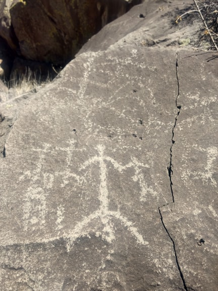
After a couple of miles we came into picture canyon, named for the petroglyphs that cover the rocks throughout. We stopped at one such site where we found depictions of waterbirds, sun and lightning. It was a pleasant stop, but the creek we followed smelled of rotten -smokey dog farts as the water treatment facility was just up stream.
We hoped to find a water cache when we crossed hwy 89A but had no such luck, so we kept hiking. We made a gradual climb up to Schultz pass, where we met the (dry) little Elden spring, a couple gallons of cached water, and the start of a logging detour. We took a little water, and continued up the detour in search of a snow melt stream. After another mile and a half, we finally found one, our first drinkable water source of the day. We took a short break here before pushing on to camp.
At some point along the detour we got separated, Mandalynn getting back on trail while the deotur technically continued west along a burried pipeline. I bushwhacked through the trees down to the trail, and then followed that east till we found each other. Luckily modern day technology was a great aide in this.
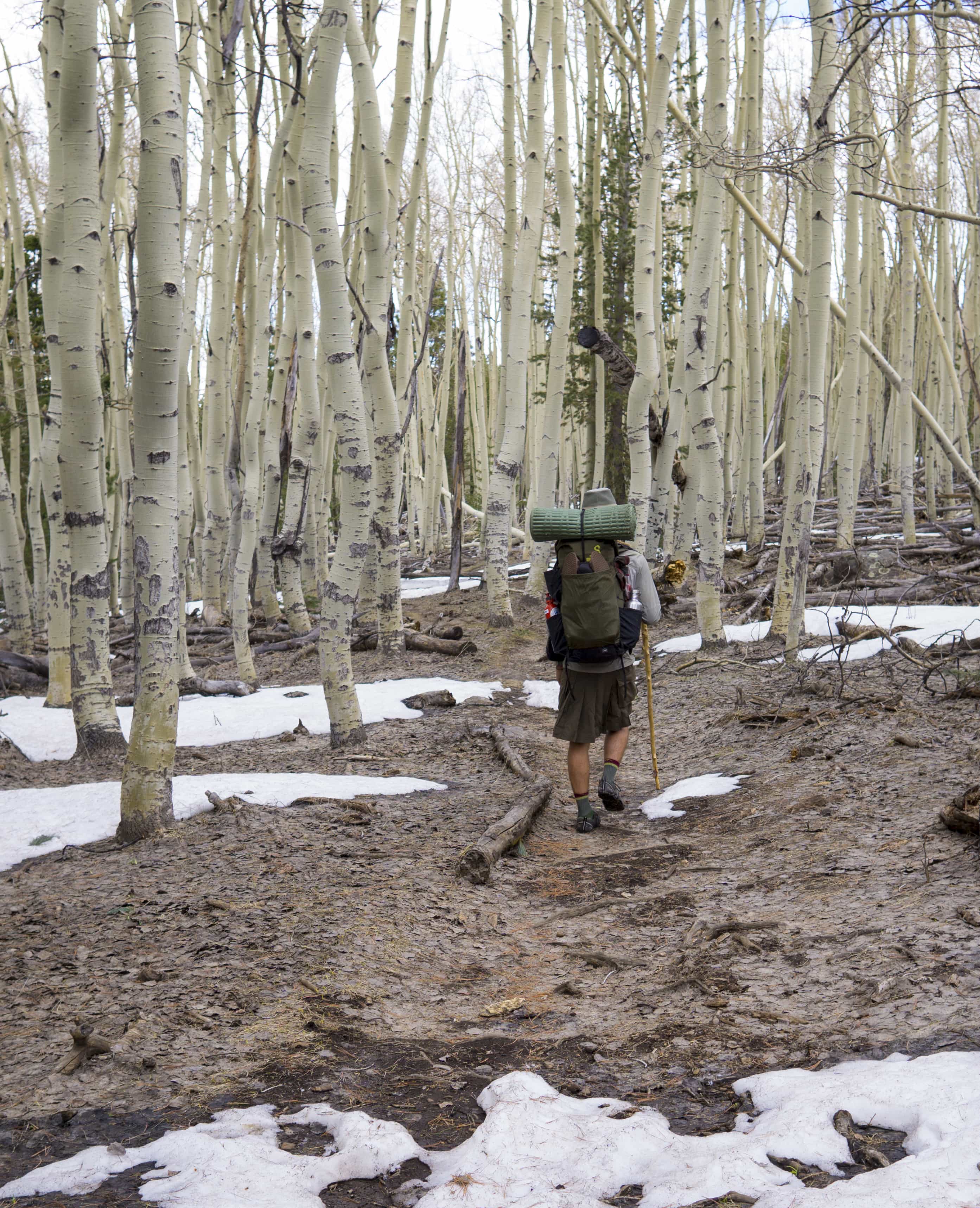
aspen groves on the back side of Kachina peaks
It was not long after this that the detour connected back in, and we made camp. It seems that they just finished a major commercial thinning, and did quite a good job. Evidently they are even logging many sections with helicopters!
Last we checked, a storm was getting ready to set in, so we set up our tarp for inclement weather and high winds. Ready to take a trail zero tomorrow if we had to, we went to bed praying for the best and planning for the worst.
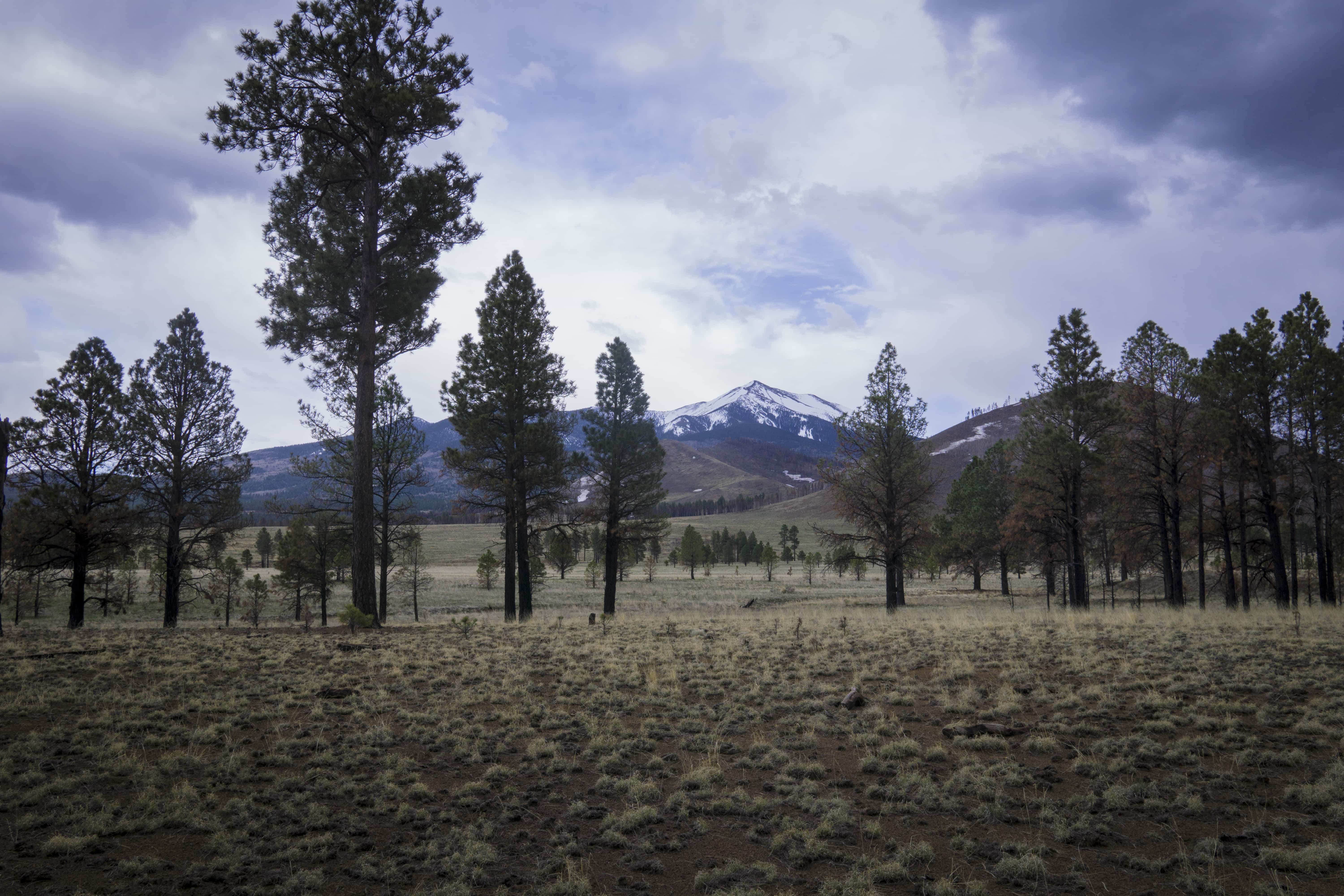
the coming storm…
When we woke, the clouds were moving in, but we could still see blue sky, and decided to start hiking. It was a long and mostly gradual climb through dense ponderosa as we made our way up to Snowbowl, the ski resort on the San Fransisco Peaks, topping out around 9000ft.
The precipitation seemed to hold off for the time being, but as we updated our weather reports, we could see that it was still coming, just delayed.
After 18 miles we came upon the Kelly tank water cache, where we were hoping to find a bit of water. There was nothing there when we arrived, and there was no water for another 12 miles. We messaged Bones to let him know that the cache was empty, as he would likely be one of the people stocking it. Decidedly he dropped what he was doing, and came out with a dozen gallons of water and a case of beer. We caught up for a while, then settled down for the night. With rain/snow on the horizon, the temperature was dropping fast and nobody was eager to stay up late.
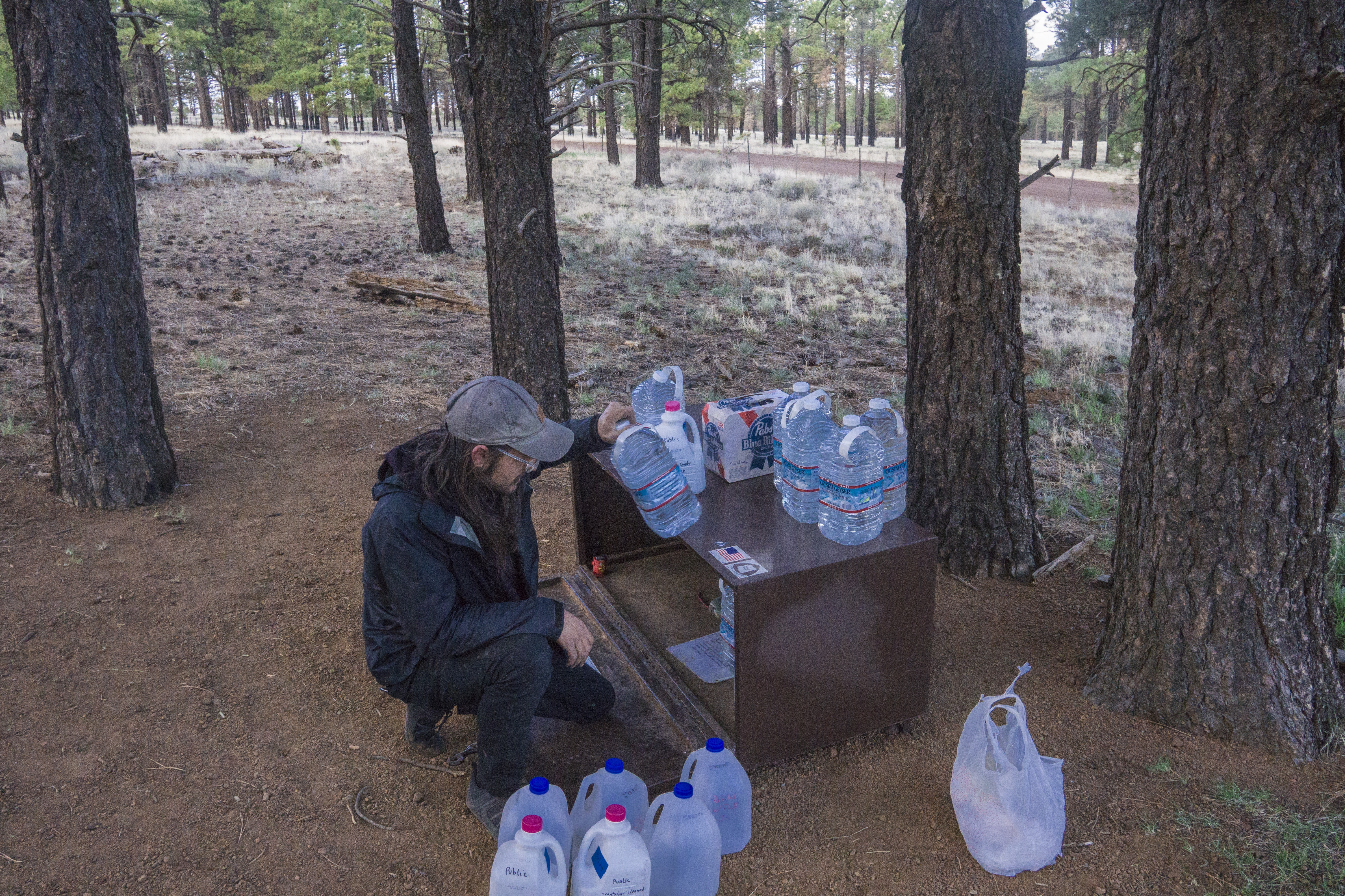
Bones refilling the water cache
Before we were really even up, we heard Bones leave for work before the sun. Soon after, we followed and began the morning ritual of coffee and breakfast.
We decided to hike out the first 12 miles to the next water source without stop. Along the way we ran into another hiker, Adam, whom we first met on day 2. We chatted with him for a while at the east cedar tank – he was wrapping up his last day on trail and was soon headed for the PCT. We enjoyed our conversation, and he even did a little trail magic for us on his way out!
As it was another 18 miles to the next water source, we decided to try for our first 30+ mile day. Since it was a road walk on mostly level terrain, the going was fast and easy.
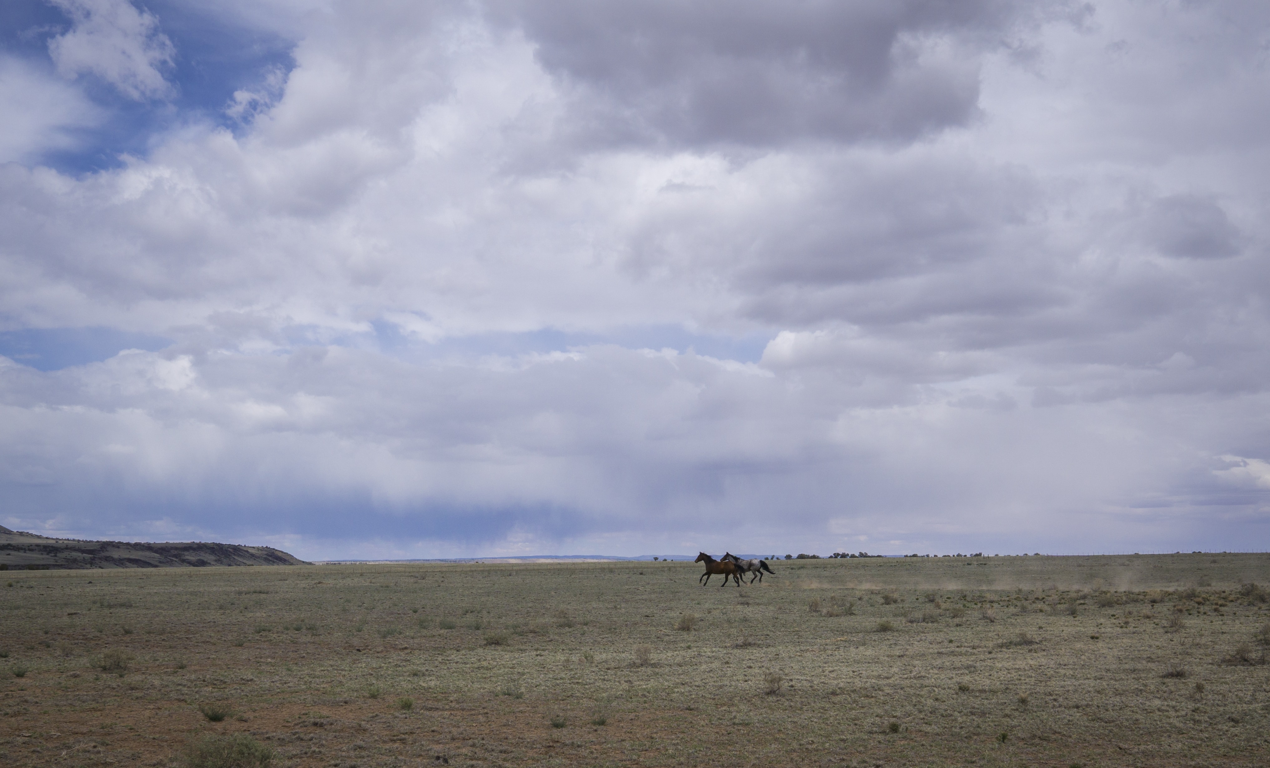
horses in the storm
We accidentally got off trail at the tub ranch, found unexpected water and surprised horses, turned around and kept walking. Nothing like a little extra hiking in the middle of our 30 mile day! We took another break near some transmission lines, and then eeked out the remaining miles into Lockwood tank. We were greeted by two bulls who eventually let us pass, and we found the water we’d been seeking all afternoon. We set up camp near by, though the angry cows made us second guess our decision. Luckily things quieted down after dark.
It seems that we successfully evaded the impending rains, relentlessly chasing us from the south.

running from rain
It was much warmer that night, and we were grateful for this. We slept well, and woke to the sounds of birds flying between the stubby Junipers. As we sat and drank coffee, dipping homemade molasses cookies, I was transported back to my grandmother’s living room, planning our day and watching the birds through the window. It was a pleasant thing, and it reminded me that soon we will be back home – even if only for a short while.
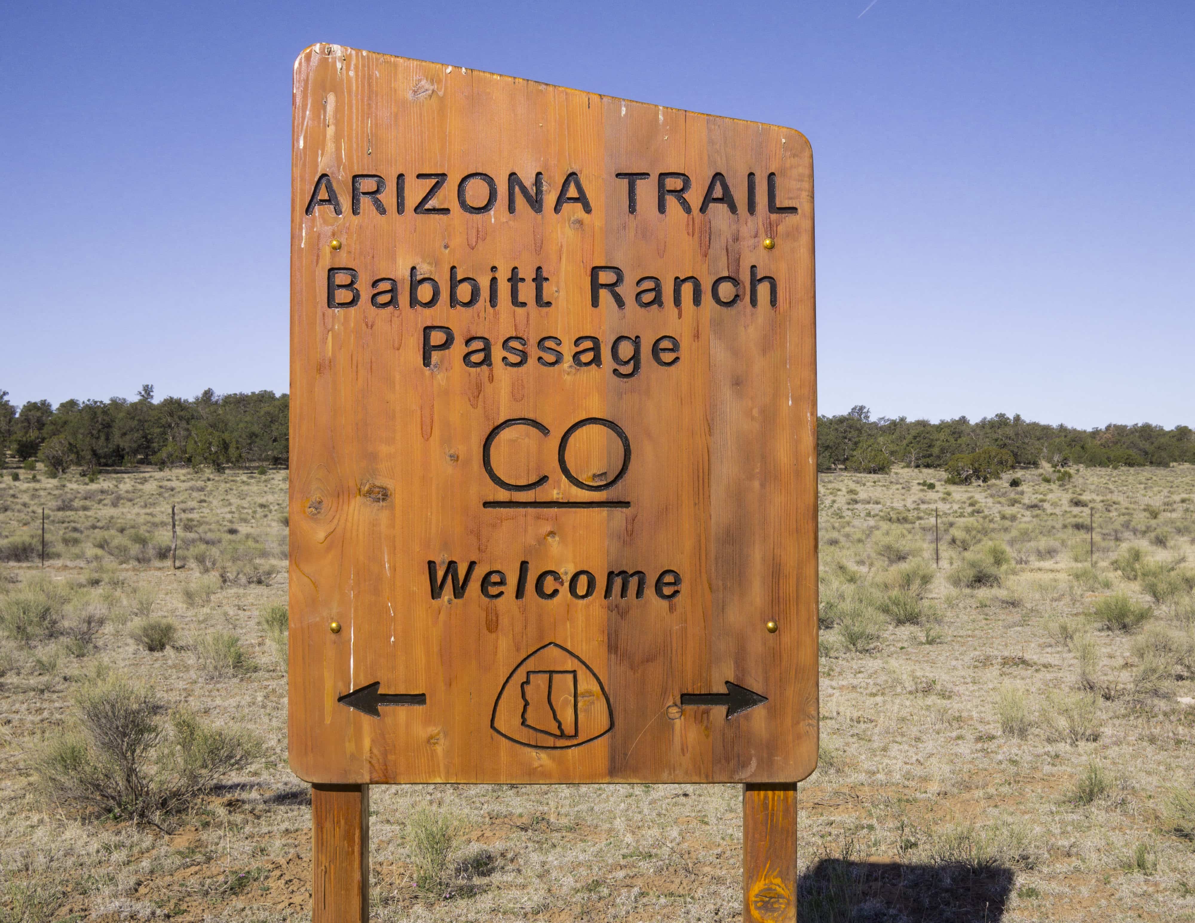
We road walked the last miles out of Babbit Ranch that morning, a 30 mile section in all. The moment we hit the national forest boundary, we got our trail back. This was a welcome sight, as our feet were growing tired of walking the dirt roads. We continued to hike through the trees, with relatively flat terrain, never seeing where we were going or where we came from. We took a 10 mile break at a large rusted water tank, only to discover Russel lake a little further down the trail.
Not long after leaving the tank, we hit our first interesting (non-flat) topography in days. At last we came out on the Coconino rim, which afforded us expansive views to the north – including the Grand Canyon itself for the first time. We followed this rim most of the day, taking breaks at various wildlife water catchments -our only water sources. Near the last of these was the grandview trail head where we climbed a fire tower and teased ourselves with the approaching canyon.
The last 5 miles of the day went faster than anticipated, and that was a good thing. We bedded down at a large roadside camp near another trail head. With sore feet and exausted legs, we are smiling knowing we did 63 miles in 36 hours. A time and place for everything…

Determined to get into town early the next day, so we could pick up our package from the post office before they closed in the early afternoon, we hit the trail with the sun and practically ran the 9 miles in Tusayan. The general store there was conveniently located just off trail, so we stopped in and did our best to make a timely trip, supplementing our resupply box up ahead. We then spread everything out on the table and began unpacking and re-packing our food, crushing chips and consolidating candy, much to the amusement of the patrons in Starbucks…
As quickly as we could we got back on the trail, chatting with the campground host along the way. He offered us a comped site, which was tempting, but we knew we had to keep moving and so did he…
It was another 6.5 miles of road walking to get to Grand Canyon Village. We hit Mather Campground first, where we were blessed with the presence of a hiker-biker camp for only $6/night. We ran into our friend Chip Crusher again, and met some new hikers, Splinter and Surly.
We rode the free bus around the village and were able to wrap up most of our errands in an efficient manner. We came to the conclusion that since camping was so cheap, along with showers and laundry, that it wouldn’t kill us to stay another day. As such, we pushed our permits back a day, leaving us a full 24 hours on the south rim. A much needed “Zero,” day.
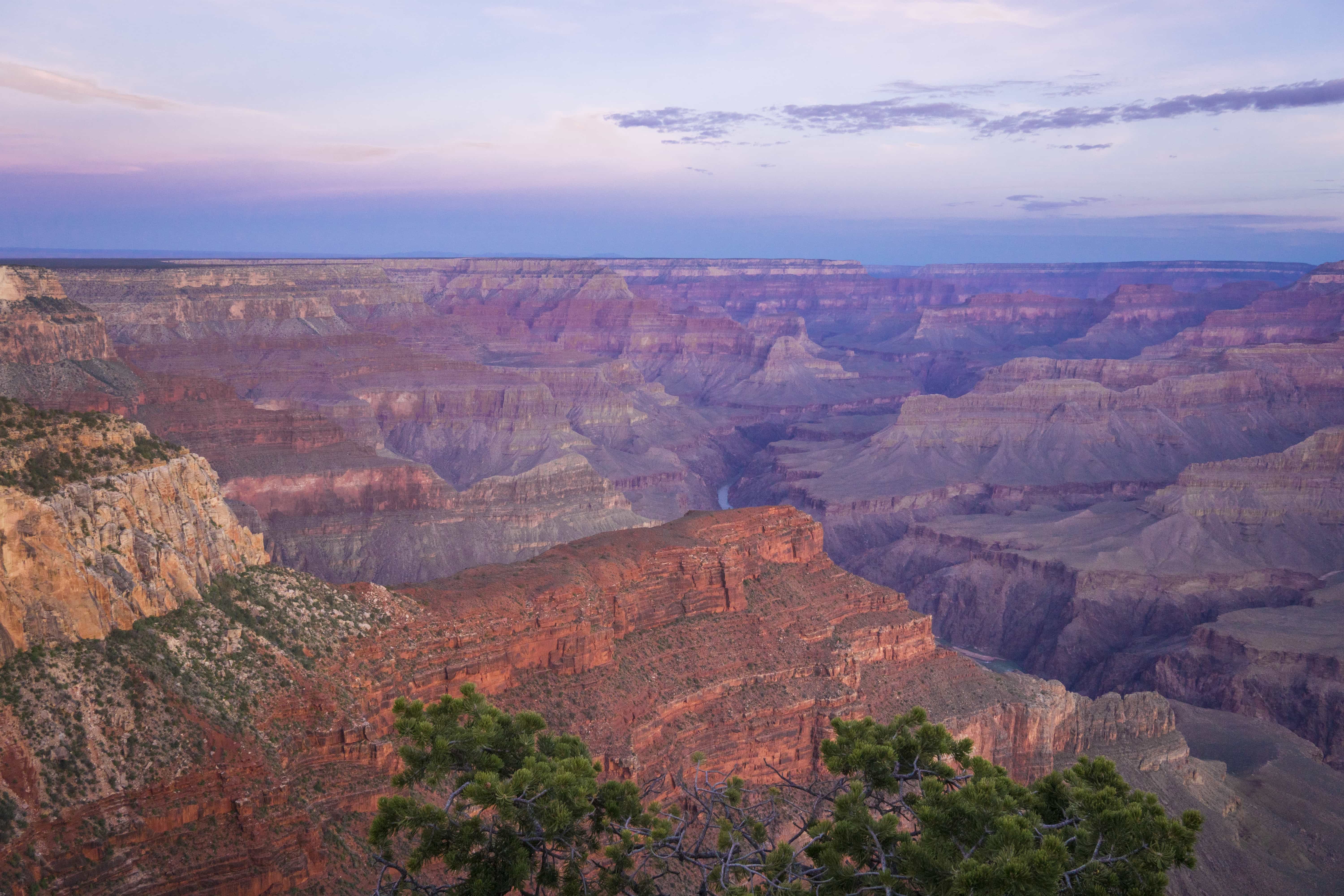
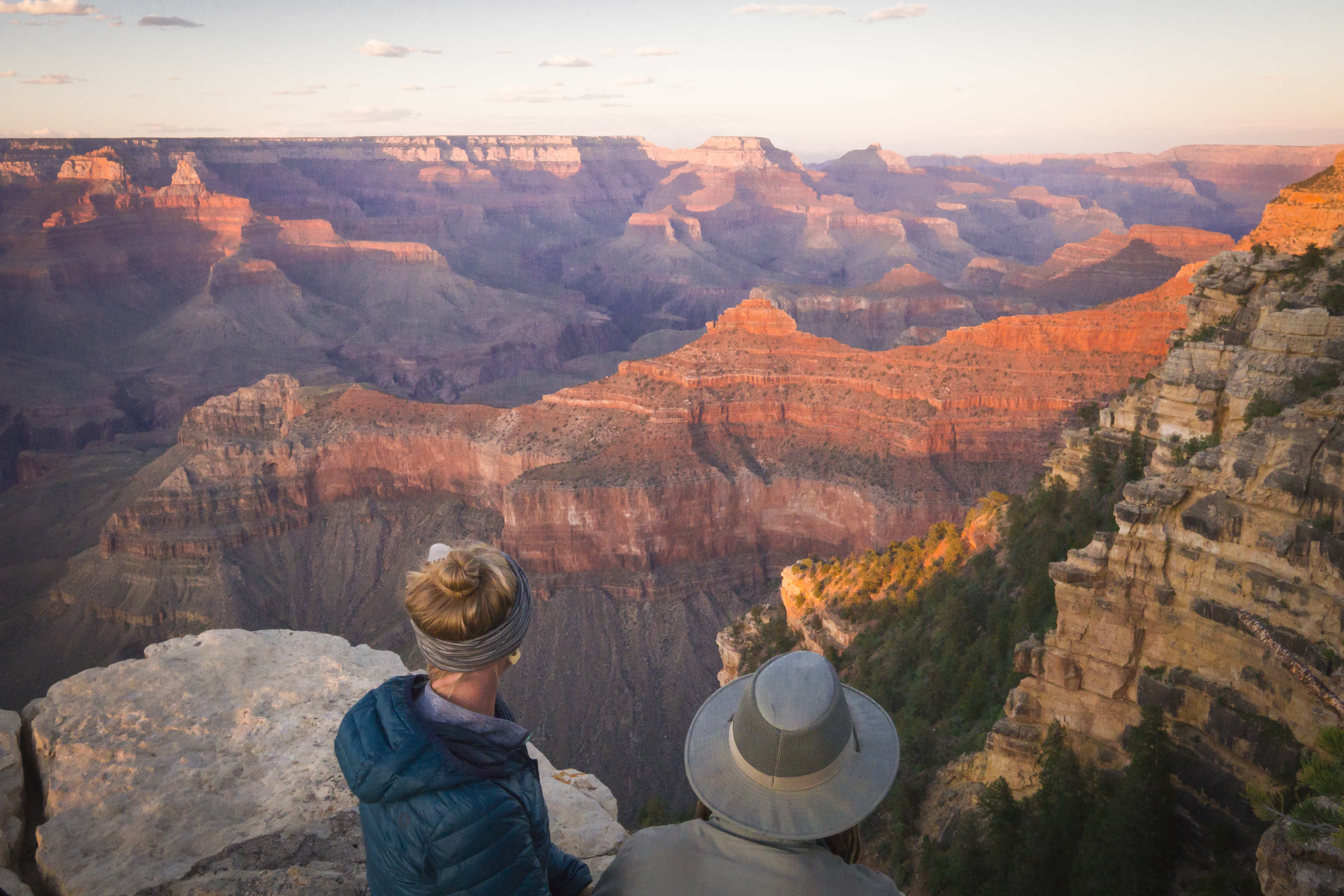
sunrise on the south rim
I got up around 3:00 am, quickly put a simple day pack together, and hiked two miles in the dark to the bus station. Around 4:30 the bus arrived, and took me and a couple other photographers down the road to our desired points of interest.
I arrived while it was still dark, and enjoyed the vista to myself for a good while. As first light began to take hold, the canyon slowly unfolded out the darkness before me. It was a magical thing to witness, and taking a bad photo here would honestly be difficult. But just before sunrise a loaded tour bus drove up and poured out its passengers onto the view point. This was a bit annoying, but I still believe that you have to work hard to truly appreciate something, and damn, was that a beautiful sunrise. Afterwards I caught a series of buses back to camp and arrived just as Mandalynn was waking up.
We spent the rest of the day walking the south rim trail, learning of the canyon’s geology and history. We got some pasta lunch from the general store, and even napped for a good while. Best of all Mandalynn found us a ride from the northern terminus to Page! Long live the kindness of strangers!
We met some more hikers, this time Ted and Larry Boy. Also met a couple of bike packers whom we did not envy (they have to deconstruct and carry their bikes across the canyon). We stayed up late in our conversations, despite an early start awaiting us.
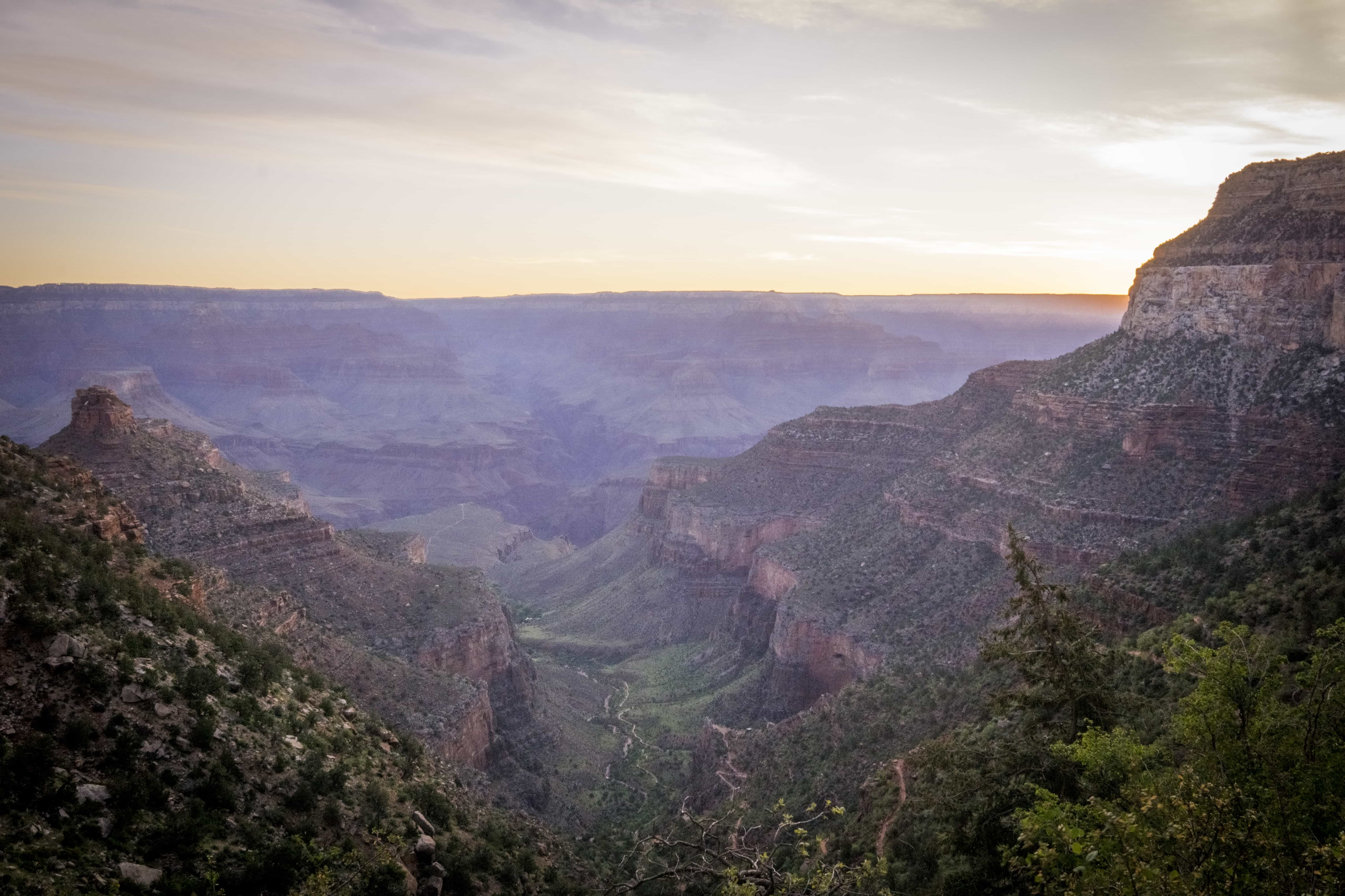
When we did get up, we did our best to break camp without waking our neighbors. When all was said and done we caught the first bus at 4:30 and rode through the majority of the village before finally arriving at our trail head.
We began hiking just before sunrise, enjoying the view and avoideding the crowds. It was a pleasant and easy hike down, especially with the out houses and water at regular intervals. We passed many people headed down despite our food laden packs, and that was a good feeling.
We took our breakfast at Indian gardens, which was a beautiful spot full of giant cottonwoods and fresh water. From here we continued to drop down into a slot canyon carved by the creek. Here the trail was carved out of the canyon walls, and was especially fun.
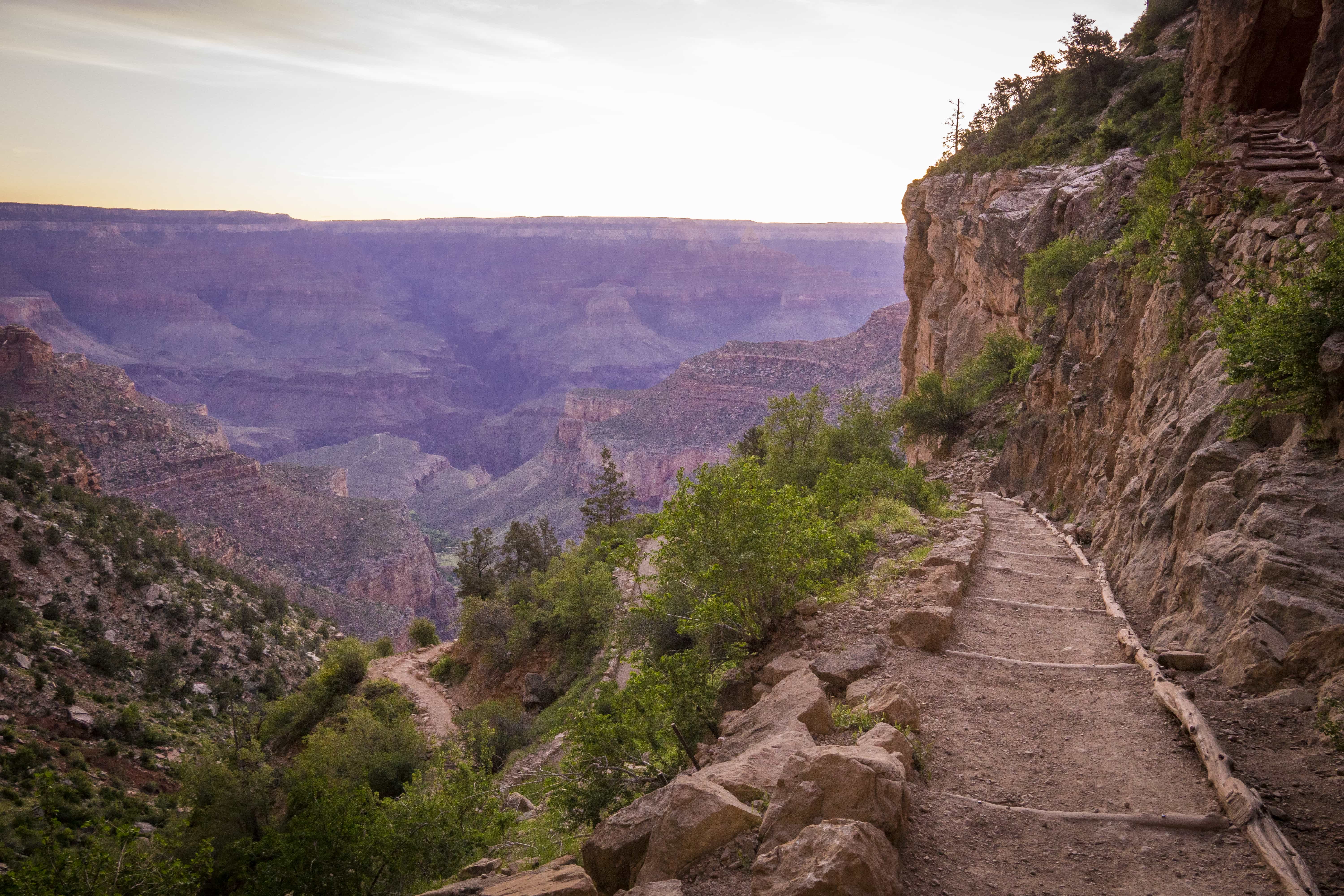
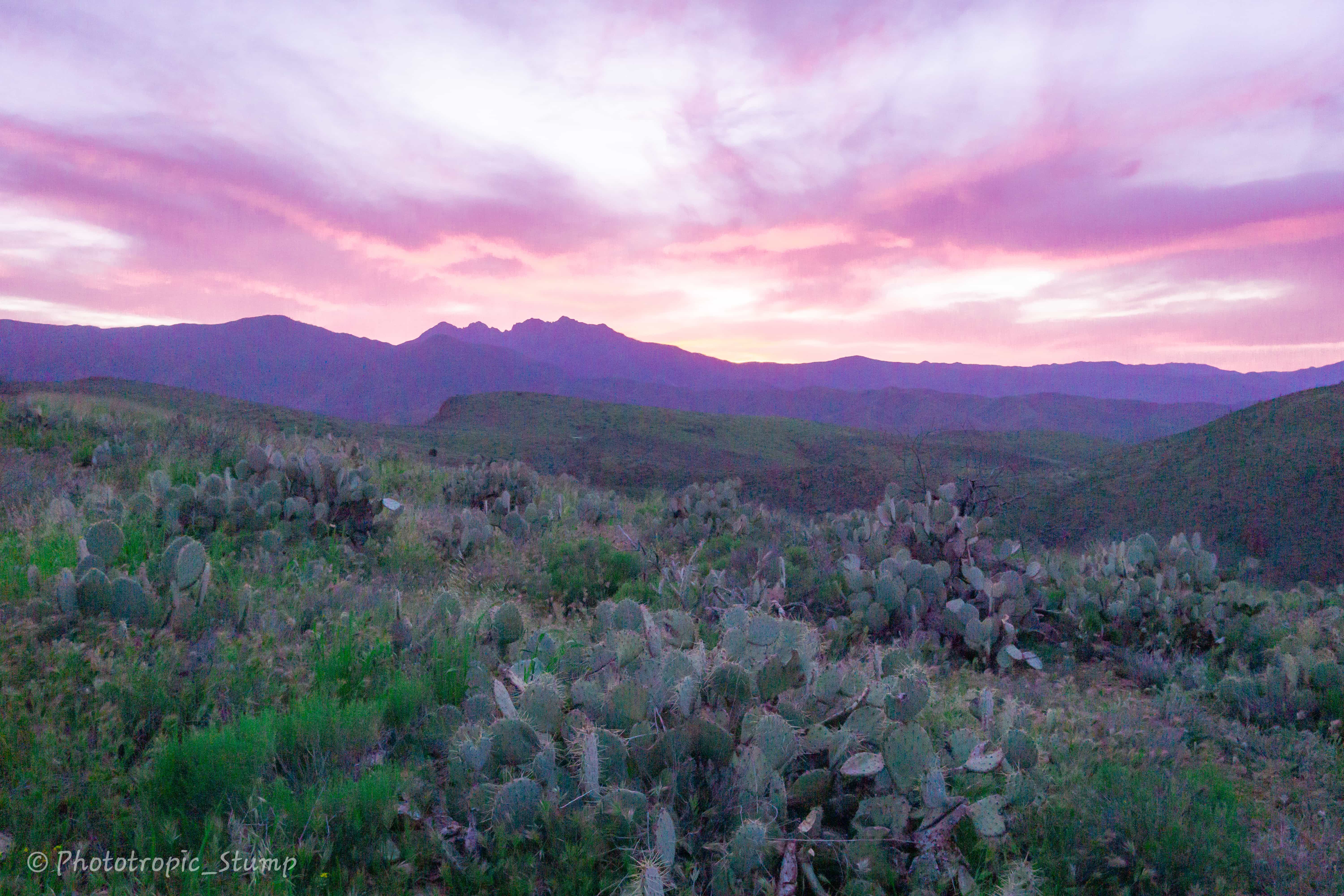
The closer we got to the river, the more miserable people began to look. By the time we got there, the heat of the day was already here and it was only 9:00 am! It is quite strange how all of a sudden we find ourselves back in the low desert where the prickly pear and brittle bush are still blooming.
We got into Phantom ranch and made our home in the stock camp. We met an older man named Tim here, whose son was ill in the infirmary leaving him to slowly pass the hours by himself. With over 80 hikes in the canyon under his belt, we racked his brain for a good while and gleamed a lot of good information; notably where we could jump in the river and cool down.

the cool Colorado – 700 miles in!
After jumping in and out the frigid waters of the Colorado several times, we walked up to the cantina where we ran into Larry Boy again. As we sat and talked with him, a professionally guided group made their lunch, and fed us the leftovers when they were done. This was only an omen for the rest of the day to come.
We talked with the guide for a good while, and she imparted on us some excellent one-liners. The best of these were with respect to the movie Wild, “You mean the girl who had a break down, went to REI, and almost killed herself?” she would say.
We continued to sit in that shade for hours, talking with Larry Boy about life the universe and everything. We talked with a lot of the hikers passing through and eventually went over to the cantina in hopes of commandeering some beverages. This did not happen, but we met a man by the name of Nish, who treated us to his leftover vegetarian stew, steak, and potatoes from the ranch. What followed was one of the most thought provoking conversations of the trail so far. We talked of hiking, the JMT, death, pooping, modern society and countless other topics. People even brought us more chili as we talked. It seems that while feeding the wildlife is strongly prohibited, feeding stray thru-hikers is an acceptable close second.
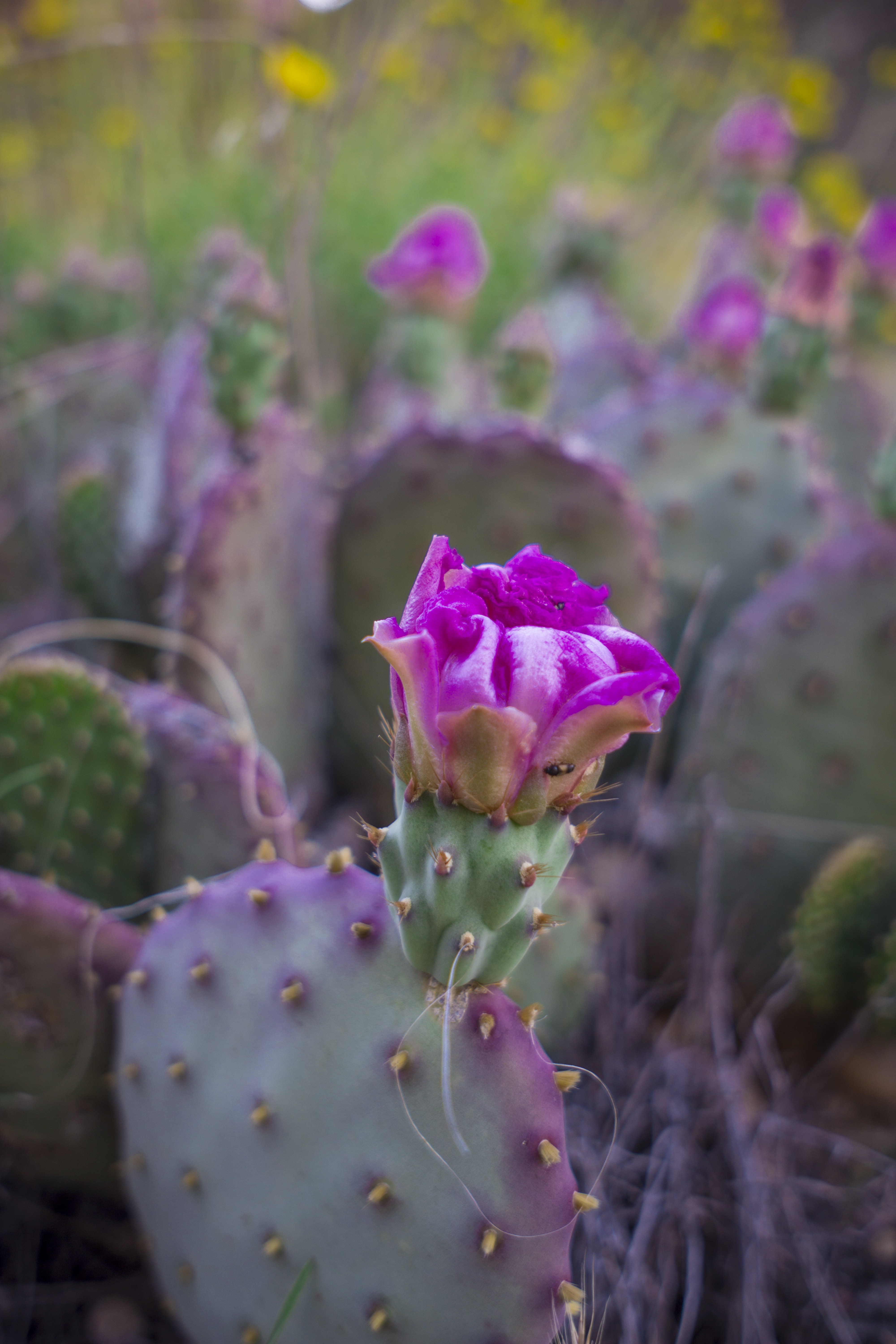
blooming prickly pear
It was one of our favorite days on trail, being fed by strangers, and making genuine connections. It was the kind of day that reminds and reassures us, that this is what we love and why. We even got Larry Boy to stay in the canyon instead of hiking out to Cottonwood camp. Though the terminus was still a few days away, this was a celebration of the end, a grand finale of sorts.
We again rose well before the sun, and started hiking our way out of the canyon as first light of day began to illuminate the canyon walls.
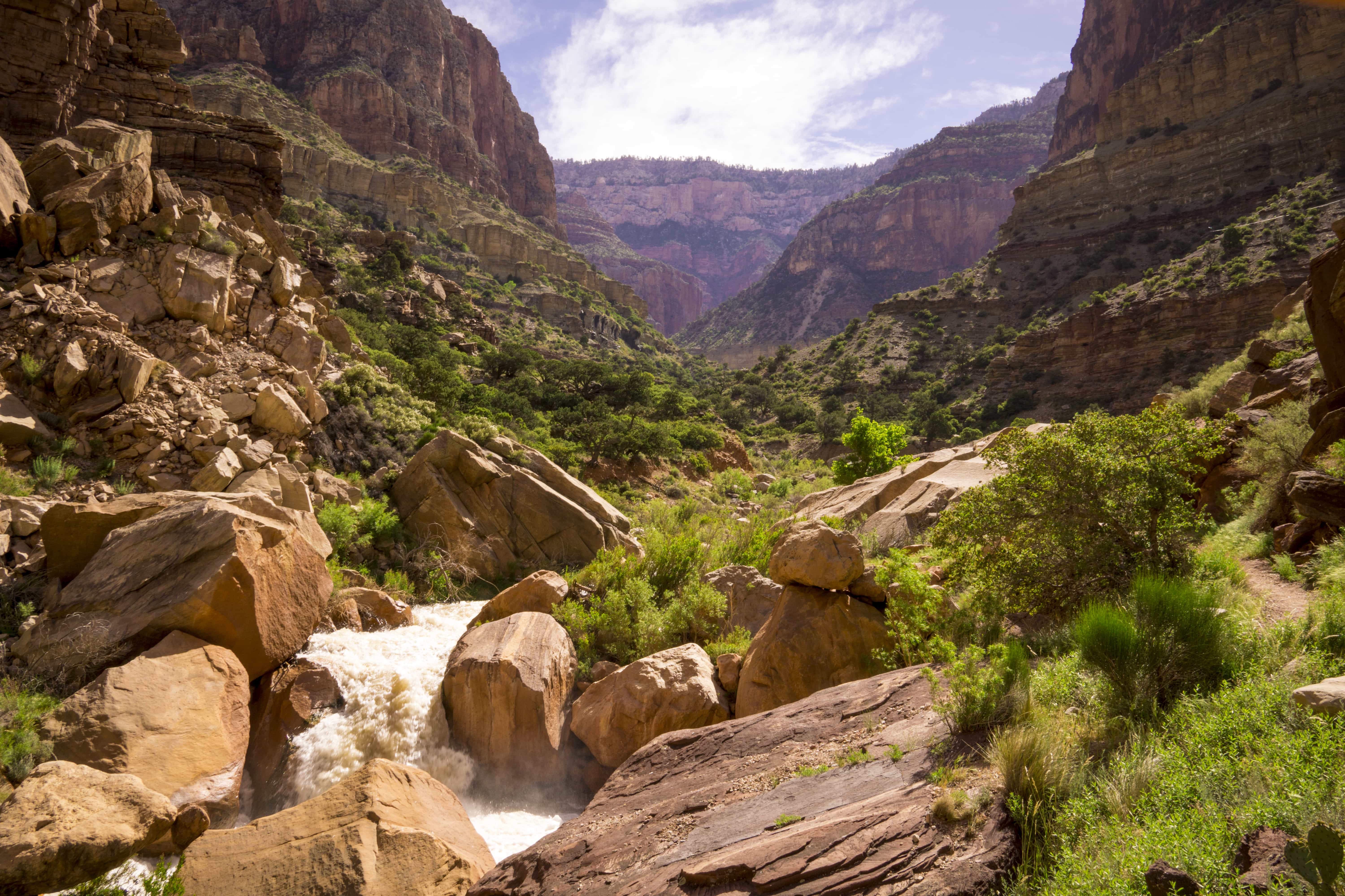
a raging bright angel creek
We followed the creek through another slot canyon it had carved out of the basement rock. This was a beautiful section, and the climb was consistent and gentle. The creek itself was flowing beyond its banks, flooded by the rapid snow melt off the north rim. Many times while we were hiking we could hear large boulders rolling and colliding under the torrent of brown rapids, like thunder in the water.
As we got closer to Cottonwood camp, the canyon began to open up, revealing views of the greater canyons ahead. The ranger cabin here was not yet in operation, and the water was off; so we hiked another mile and a half to the manzanita creek pump house, where we topped off our bottles and ran into our bike-packer friends again, from the south rim campground. They were having a hard go of getting through the canyon with their bikes; between the discomfort of carrying a bicycle over intense terrain, and the sudden demand of muscles associated with hiking instead of riding -we again did not envy them.
After Cottonwood, the climbing got much steeper, and as we wrapped up the canyon, we feasted our eyes on the greatest set of springs we’ve ever seen. Everywhere the water found an exit, it came gushing out creating massive cascades that rippled down the mountain. From where we stood, we could see at least 9 distinct gaps in the rock where water was raging out. The quantity of water was absolutely mesmerizing. It was as if there is a massive lake inside in the mountain that is rapidly draining out as fast as it can. How it has flowed for so long makes my mind spin.
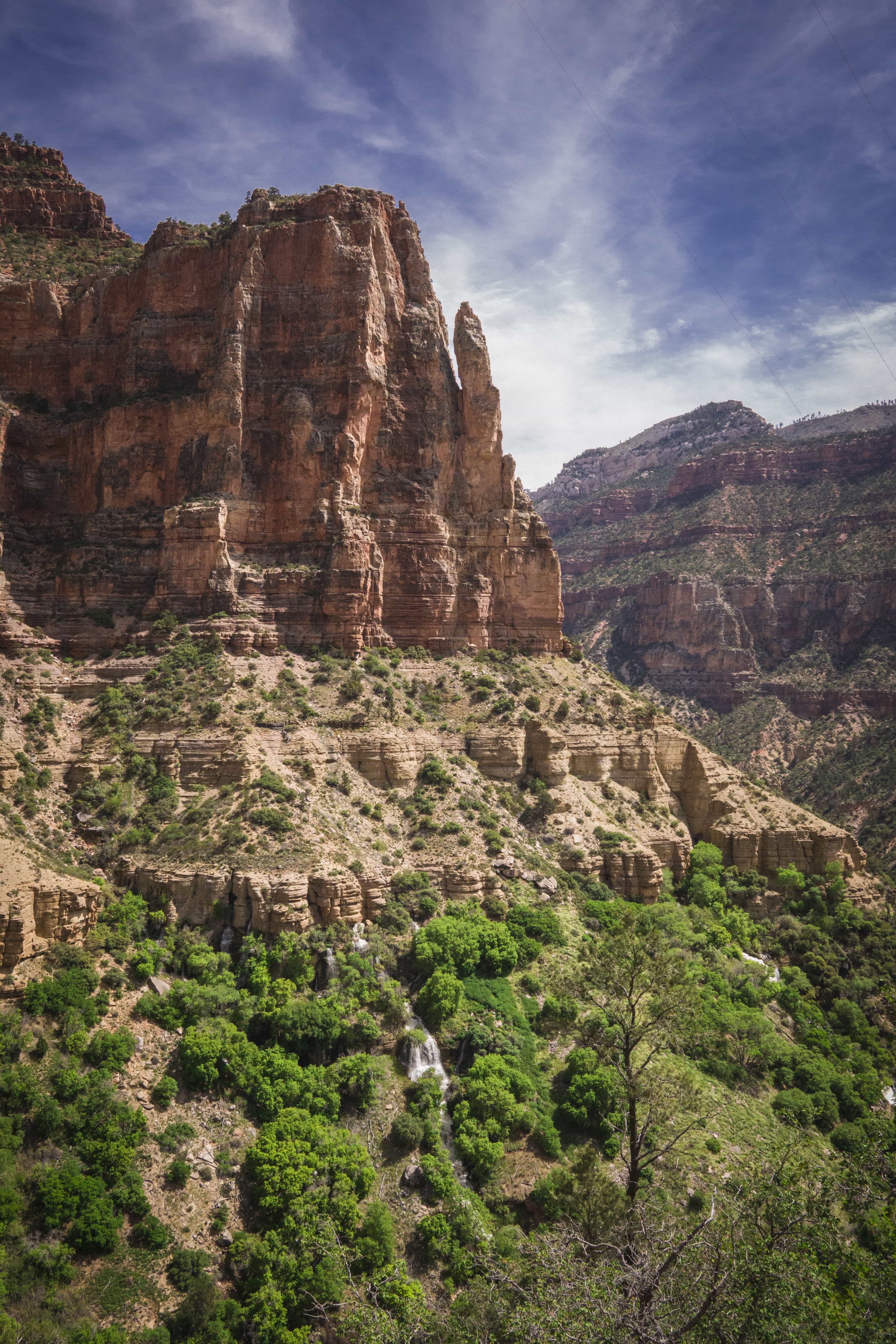
water in mountain!
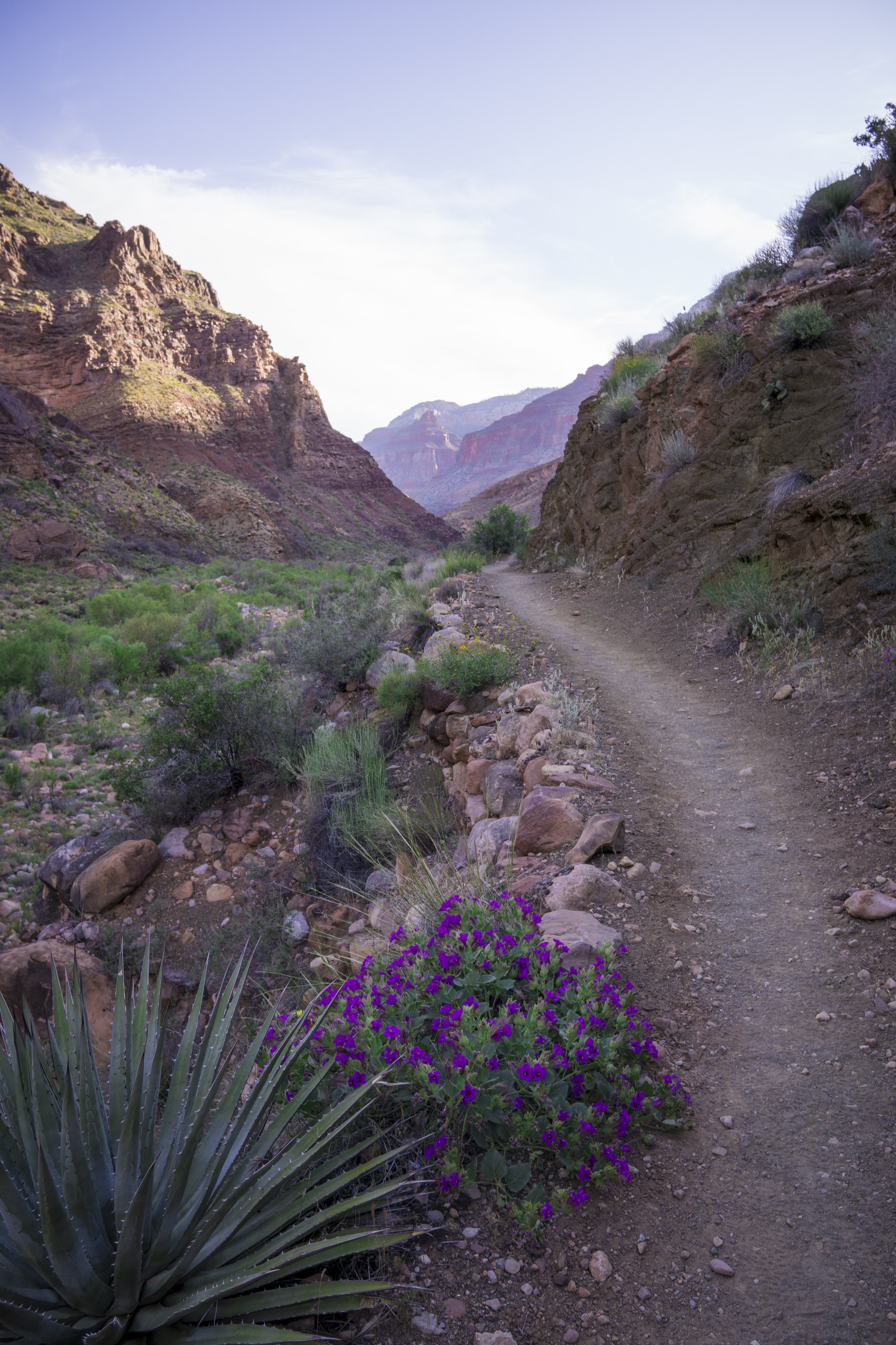
After taking a detour down to the springs and drinking its sweet water, the climing got even steeper as we made our way up the supai formation. Tight switchbacks carved into the cliff side defined this section, and made for more astounding views. As we neared the top of the rim, the steepness of the hike and the heat of the day began to take their toll, and each step took more effort than the last. We often thought of the bike-packers, and their struggle made our situation seem like a walk in the park.
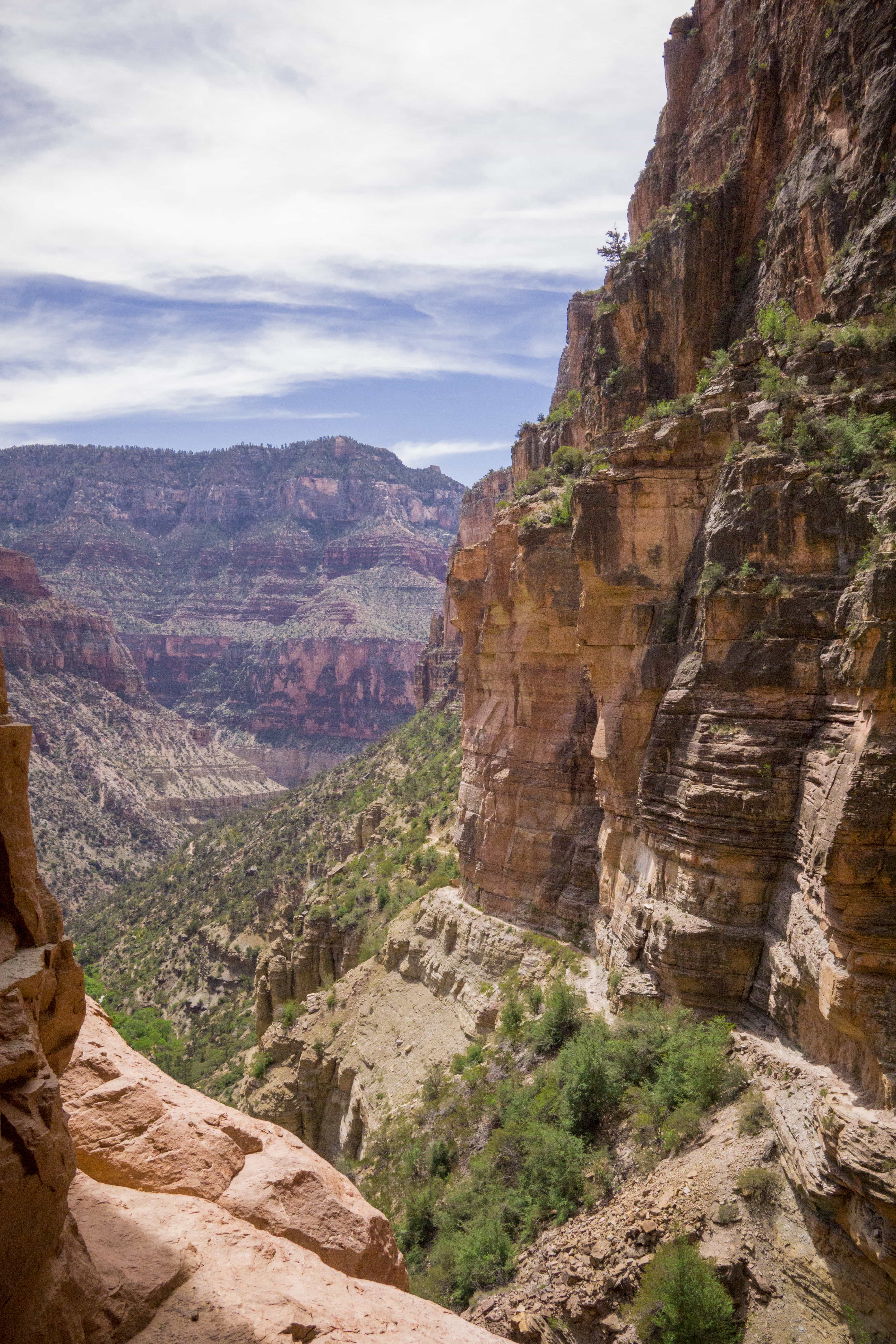
the trail out of the canyon
As the heat of the day climaxed, we reached the top. It was a needed sight, and while there was snow, there was much less than we anticipated. After all, the north rim is 1500ft higher in elevation than the south. We walked half a mile down the road to the nearby north rim campground, which we had all to ourselves as it was still technically closed for the season.
We hiked down to the rim of the canyon for sunset and found a great rock out cropping. From here we could see the canyon, including several of its temples, and even the San Fransisco Peaks distant to the south. To see everything illuminated at once through the sunset was a great reward after the miles we’ve come. Our bike-packer friends even arrived just in time to enjoy it as well.
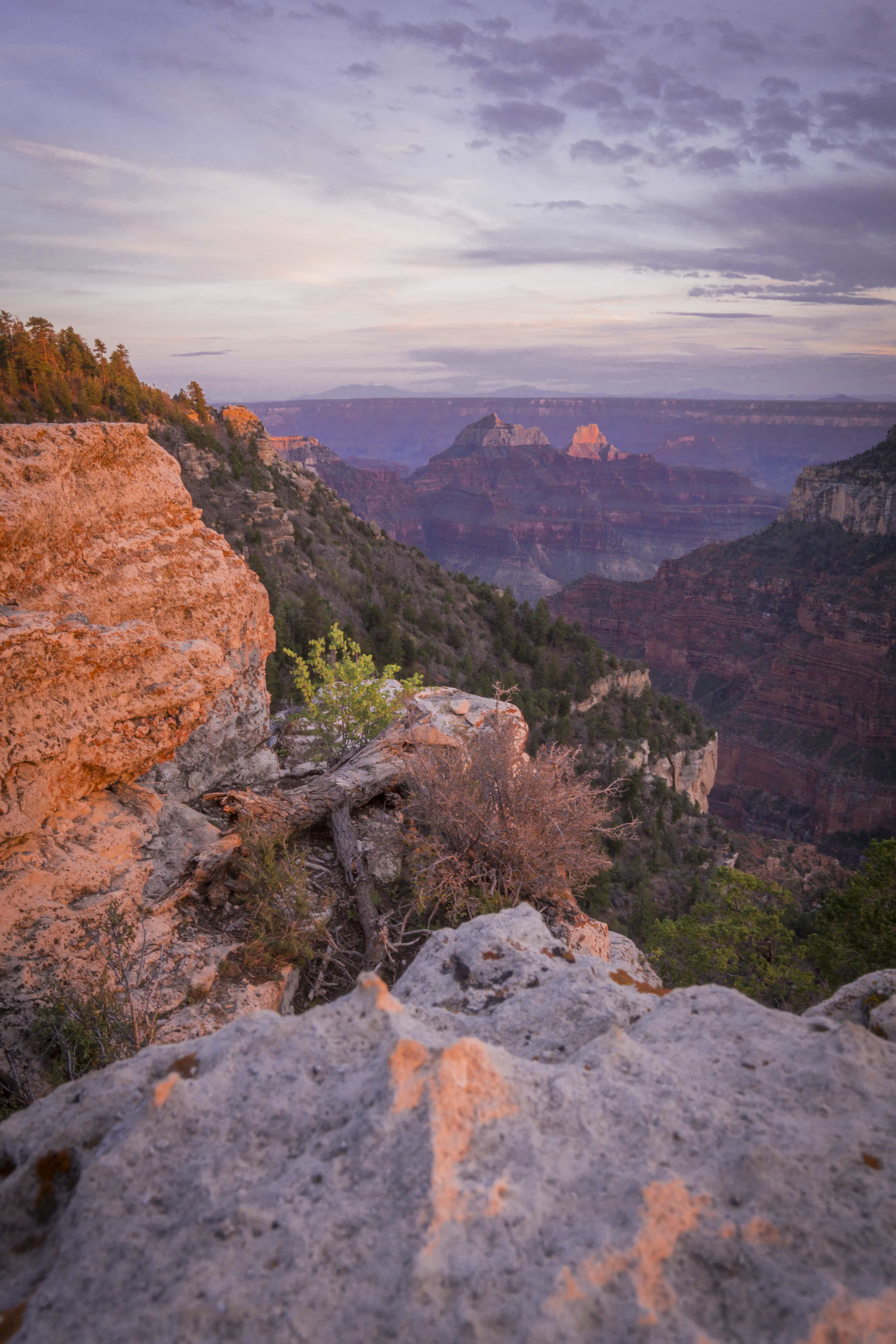
the path behind us…
With cold precipitation in the forcast, we hoped to finish in the next few days, but as always we are at the whim of the sky….
Throughout the night the sky dribbled on us, but nothing we wouldn’t hike in. That is, until the sun came up. The deluge was released from the clouds, and poured down with no relief. Our bike-packer friends headed off for Jacob’s lake, while another hiker, Matt, who slept in the pit toilet, headed for a cabin 18 miles down the road.
We decided to wait out the storm for a day, as there are some convenient amenities of being in the campground, even if the services are limited at the moment. There were a few breaks in the rain throughout the day, but nothing more than a couple hours at a time. When it did rain, it often brought hail, thunder and lightning. We spent the majority of the day under the low-pitched tarp, eating and resting, and eating some more.
No more hikers came through today, and we saw only a few miscellaneous parkies wandering about. While we are becoming restless and more eager to finish by the moment, deeper down we were glad we stayed put for the day; the alternative would likely be soaking wet and freezing cold.
When we woke up the next morning, there were two surprises. First, all the rain on the tent had frozen into sheets of ice, and now weighed down the sides of the tarp so they sagged inches above our sleeping heads. This resulted in a lot of condensation on the inside of the tarp, so getting up and packing was a slow and tedious process. Second, it was snowing. Occasionally it would turn to hail, but for the most part, big fluffy white flakes were coming down. Weren’t we just looking at prickly pear blossoms?
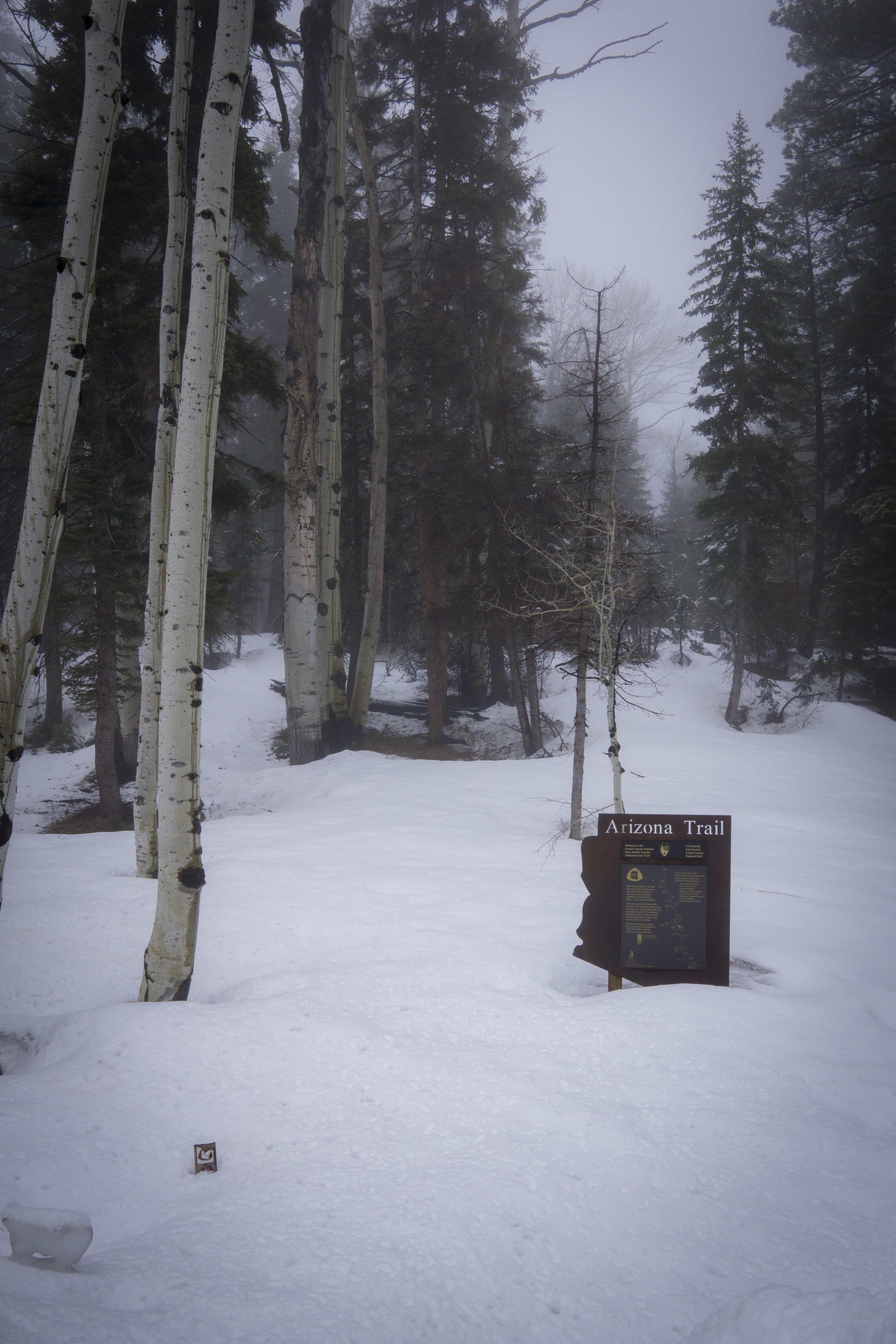
just a bit of snow
By mid-morning the snow let up and the clouds lifted a little, so we decided to make our great escape. Terminus fever was setting in, and we were dying to get further north. With all of our warm layers still on, we set out down the road. the trail here was still under several feet of snow, and the rain erased any history of tracks that may have existed there. So we opted for the road, despite its toll on our feet.
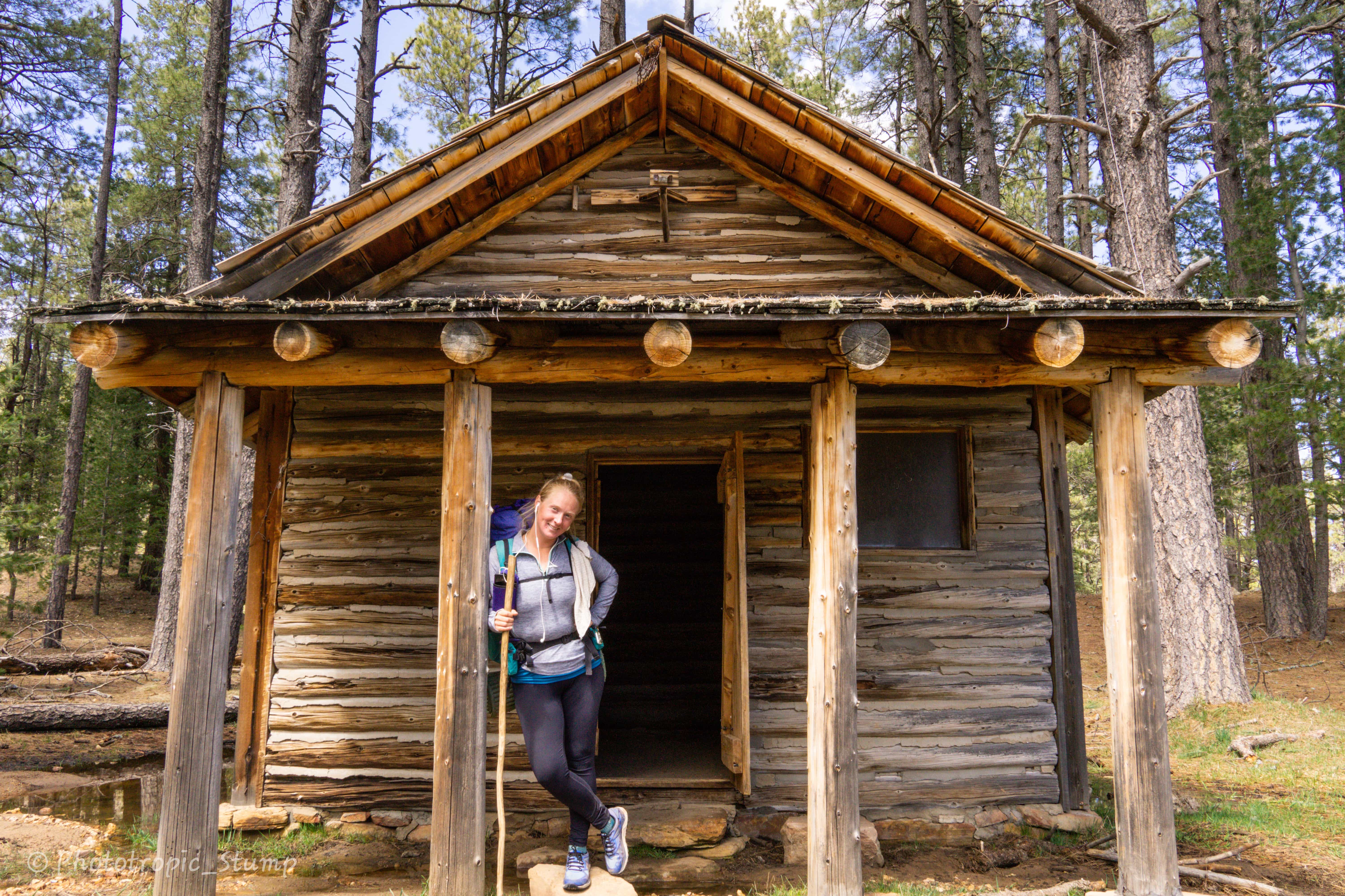
All day as we walked, thick dark clouds constantly teased us with more rain and snow. As we first set out, visibility was non-existent but slowly improved as the day went on. By afternoon the clouds were just over head, creating rapidly morphing shadows on the snow covered meadows below. After 20 some odd miles of road walking, we came upon a 100 year old log cabin, left open to the public and those who need it.
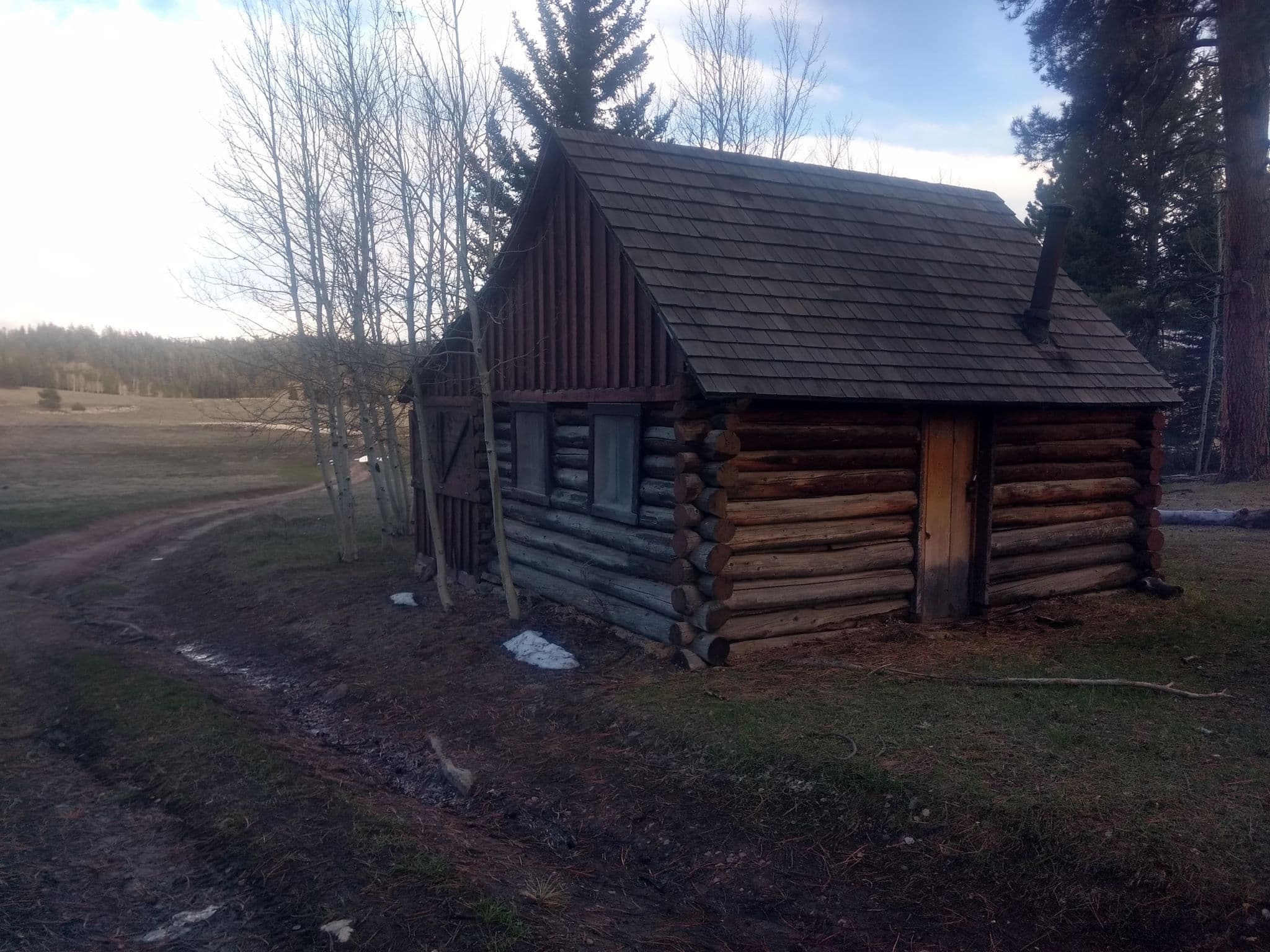
home for the night – a 100 year old log cabin
As we approached, we could see smoke coming from the outside, and our hearts sank as we feared we may be crashing someone’s weekend get-away. But as we got closer, we could see no vehicles, and come to think of it, wasn’t it Tuesday? Now we could see one of the men outside was wearing low cut shorts… At this point we determined they must be other thru-hikers, and we walked up with smiles and introduced ourselves. JJ and Shaman made us feel right at home, and we kicked it off with the two of them like old time friends. The cabin was a much needed break from the elements, and with a fire already going, we warmed our bones and hearts.
We hiked with our new friends throughout the next day, but parted ways at Jacob’s Lake. We hiked till sun down, with the terminus fever still going strong.
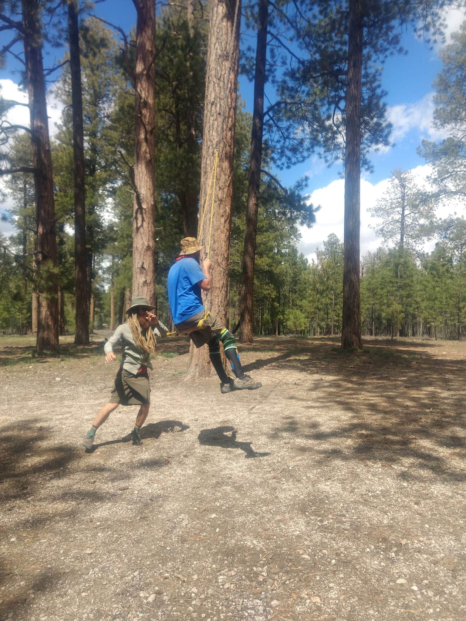
impromptu swing session with our new friend JJ
Too excited to sleep, we got up well before the sun, only to discover the condensation on our sleeping bag had frozen solid in the night. As we leaned up, the crunching sound was our first clue. Luckily hiking is a great way to warm everything up…
As we made our final miles into the northern terminus, we quickly dropped in elevation, and we found ourselves transitioning back into the heat of the desert. The trees gave way to small and scrubby Junipers, and the views opened up to massive red rock formations, barren and desolate; concealing any number of slot canyons.
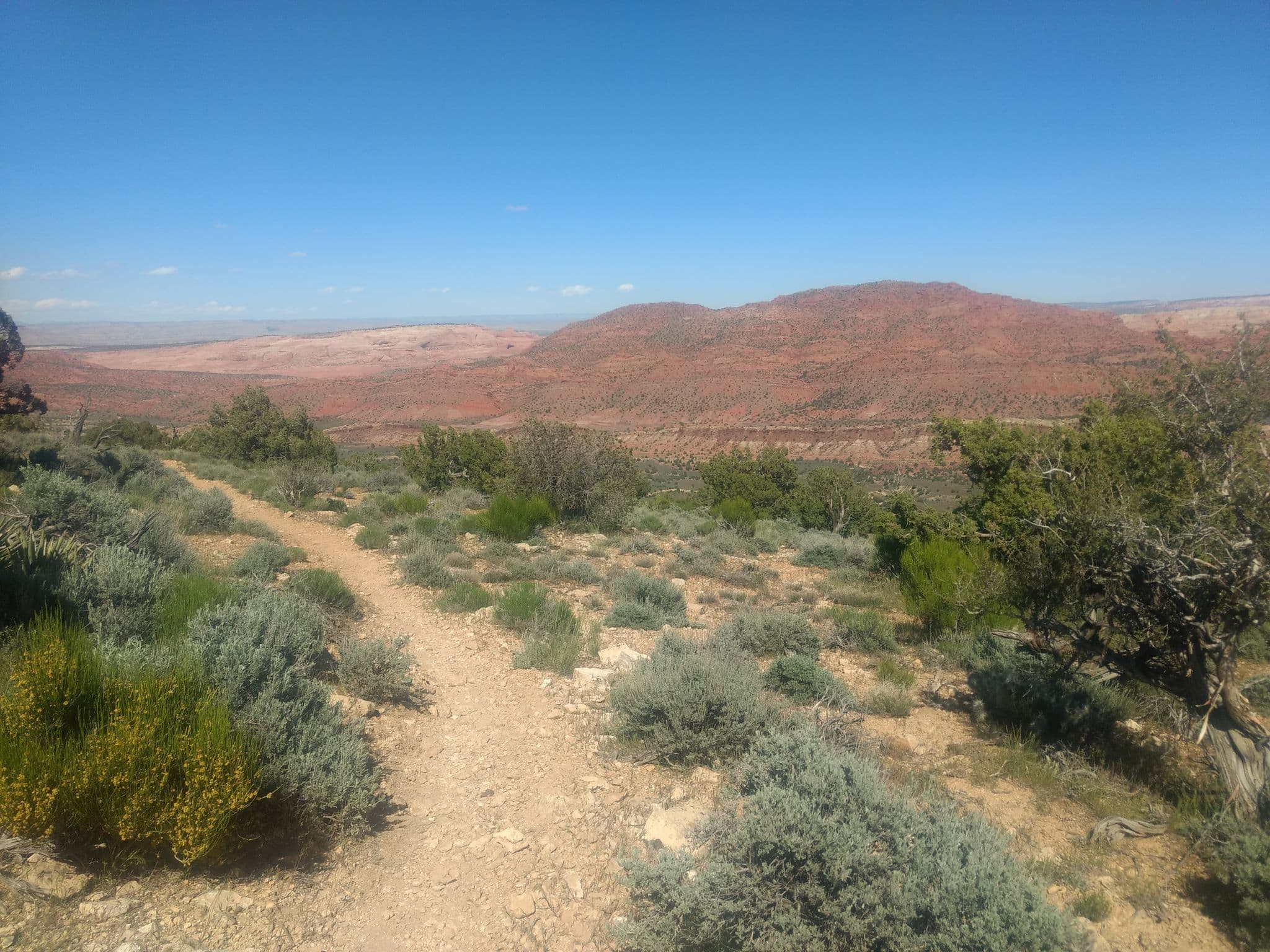
Utah!
At last we reached the Utah border, a bittersweet site we’d been dreaming about. It is hard to explain the emotion that accompanies the completion of a life long goal. Perhaps it is a mix of sorrow for the journey you never want to end, and equal parts ecstasy for what you have accomplished, but there is also a feeling of ambivalence, for life is a thru-hike, and we keep on walking.
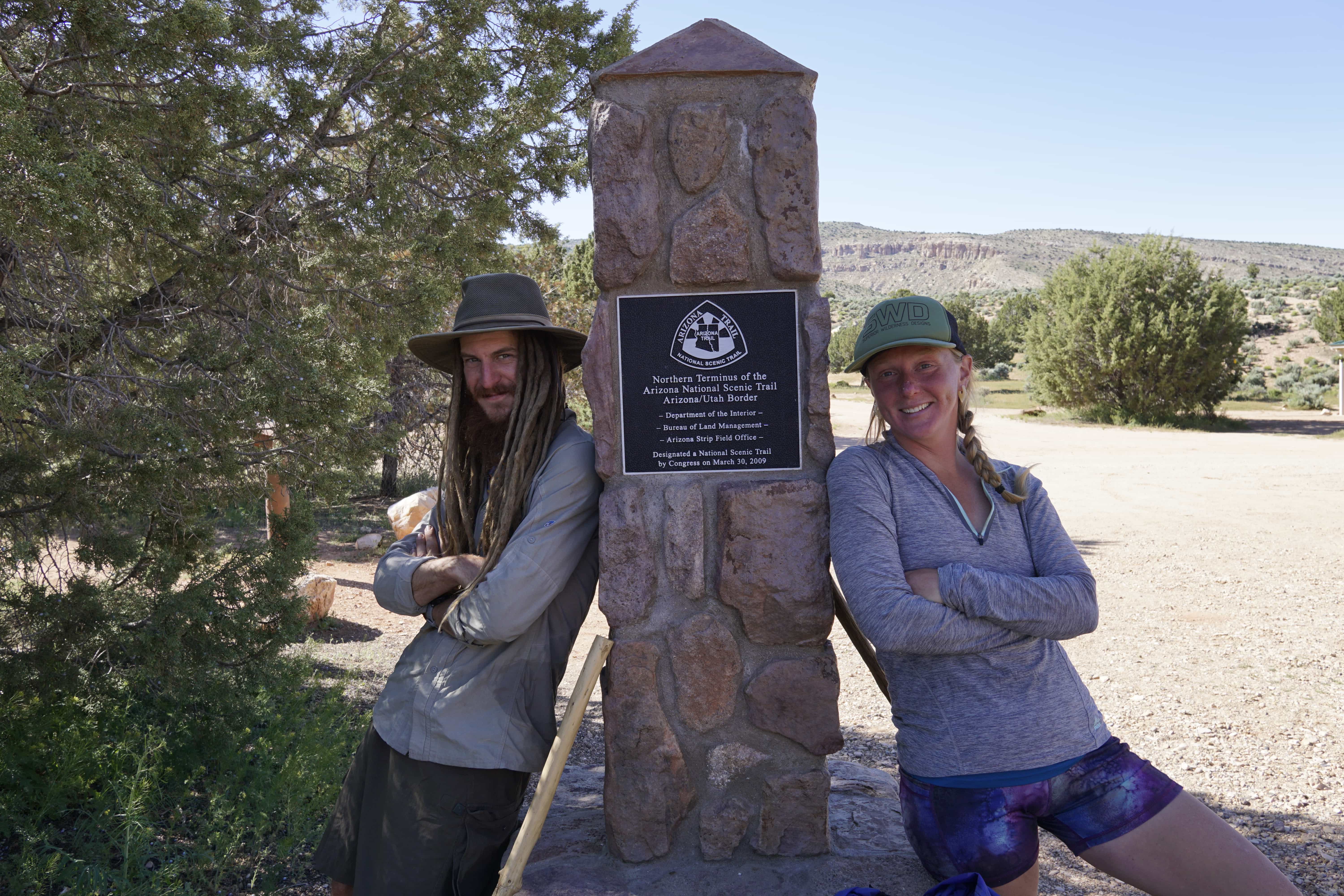
Through the kindness of strangers, we spent the night in Utah with our new friend Detour. Another amazing human being whose generosity is beyond words.
Stay tuned as we gear up for a south bound trip down the Appalachian trail, starting early this June. Happy trails!
Stump & Mandalynn

4 Comments
!!!!!!!!!!!!!!!!!!!!!!!!!!!!!!!!!!! AMAZING !!!!!!!!!!!!!!!!!!!!!!!!!!!!!!!!!!!!!!!!!!!
SO PROUD OF BOTH OF YOU!!!!!! It must really be an incredible feeling meeting life long goals, and getting to come up with new ones!!
Walking all over the West and now headed East to do it there!!! awesome-what a life for newlyweds!
So so so fantastic, lemme know if ya need anything sent out to those old mountains across the plains!!!!
YUGEEEE hugs from the Northwest.
So wonderful to hear from you! We are certainly enjoying a little time off, but the idea that we have finished the trail is only beginning to set it. In the mean time we are gearing up for another big road trip. Wish we were headed your way, but I don’t think it’s in the plans this time around. Will certainly keep you posted, and hope to see you again soon! Safe travels!
It has been great to follow along on your guy’s journey. Hope you guys enjoy the trail and each others company, as you guys plan your next thru hike!
In reading your Adventure story /documentary I feel as though I have shared some of it with you. I know I cannot truly understand the depth of emotion and physical exertion, but the amazing Beauty expressed in your writings are a wonderful vicarious experience of life! Thank you both so much for your courage, bravery, and desire for adventure of exploration of this beautiful world we live in! Miss and love you two so much!!