
Oh Virginia

Miles & Milestones
October 3, 2019
Last of the White Blazes
November 23, 2019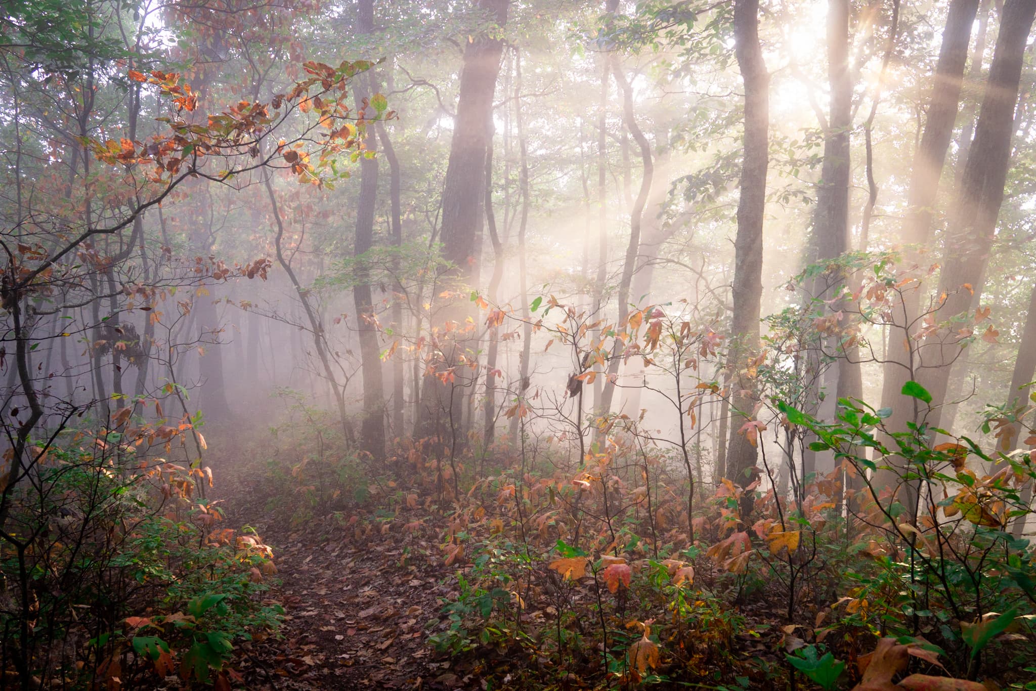
Excited to make some miles after several days off, we woke up in the dark and were hiking by 5:30. It was a cool pleasant morning, and we saw many young deer in the early light. The ridgeline we walked along also happen to be the state line between the Virginia’s, so the first couple hours we walked with one foot in each state.
We made a quick ten miles by 10:00, and eventually left the ridgeline and headed into Virginia for good. By lunch we had made good time, but the infamous “Rollercoaster,” still lie ahead. Thirteen miles of abrut ups and downs, the rollercoaster slowed us down as the afternoon heat cooked us from inside out. But by mid-afternoon we reached our camp and called it a day. Twenty two miles for our first day back felt like a good day.

Much to our surprise, we woke up in the morning to the sound of rain. There was no thunder or lightning, but the frequent gusts of wind blew the light rain up under our tarp, misting our gear during the early hours.
When we checked the weather it indicated that the rain should let up within the hour, so we slowly packed up our things and waited beneath the shelter. Soon we were convinced that the big drops we heard were nothing more than the wind, blowing the last of the rain down from the tree tops. So with high hopes, we hit the trail and started the day.

For a couple hours the clouds seemed to be lifting, but by afternoon we were back in a fog. As the day grew later, the fog only thickened; anything that had miraculously stayed dry unto this point was now soaked. It seemed that we were a living component of the water cycle. Water in the air would spontaneously down pour for a few seconds, only to be immediately evaporated so the process could be repeated a moment later. It was an indecisive deluge that teased us all night.
The next day saw little improvement, as we continued to hike through the mist. Occasionally we would drop below it, but as we made our approach to the Shenandoah mountains, our ascending grade brought us right back into the clouds.

The fog lingered into the night, but sometime in the early hours before the sun, it began to thin and soon dissappeared all together. When we got up, the moon was shining clear and bright, having been full the night before. The air was cold and crisp, one of the coldest mornings in recent memory.
We started hiking by headlamp, and as we graduallly climbed a prominent ridge, first light and the sunrise filtered through the trees to the east.
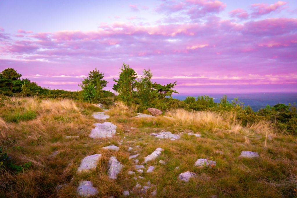
Soon we crested the Shenandoah divide, and began a series of lesser climbs and falls. Along the way we got some excellent views of the greater range and the valleys down below, but the most expansive views could be found along skyline drive; the national parkway that parallels the trail for the duration of its time in the national park.
As the day went on, we ran into a lot of day hikers and tourists. While we had become accustomed to the same familiar faces on the trail everyday, all of a sudden there was an abundance of weekend warriors, section hikers, and other hiking enthusiasts.
Despite all the people, it was a beautiful fall day in the park, the kind we had been dreaming of for quite some time. Even in our climbs we never got over heated, and a cool breeze helped to dry out the last of our damp gear. After one last climb up to Mary’s Rock, we called our day at the Bird’s Nest #3 shelter. Perched in a little saddle on the ridgeline, it was beginning to feel like we were getting back into the wilderness.

Out of a lack of available camping spots at the shelter, we opted to just cowboy camp under the stars and moon, the first time we’ve done so one this trail. Every time I awoke in the night, the moon was shining bright, and I easily fell back asleep knowing we would stay dry. By morning most of our gear was drier than when we had gone to bed – a very nice change in pace from the last couple weeks.
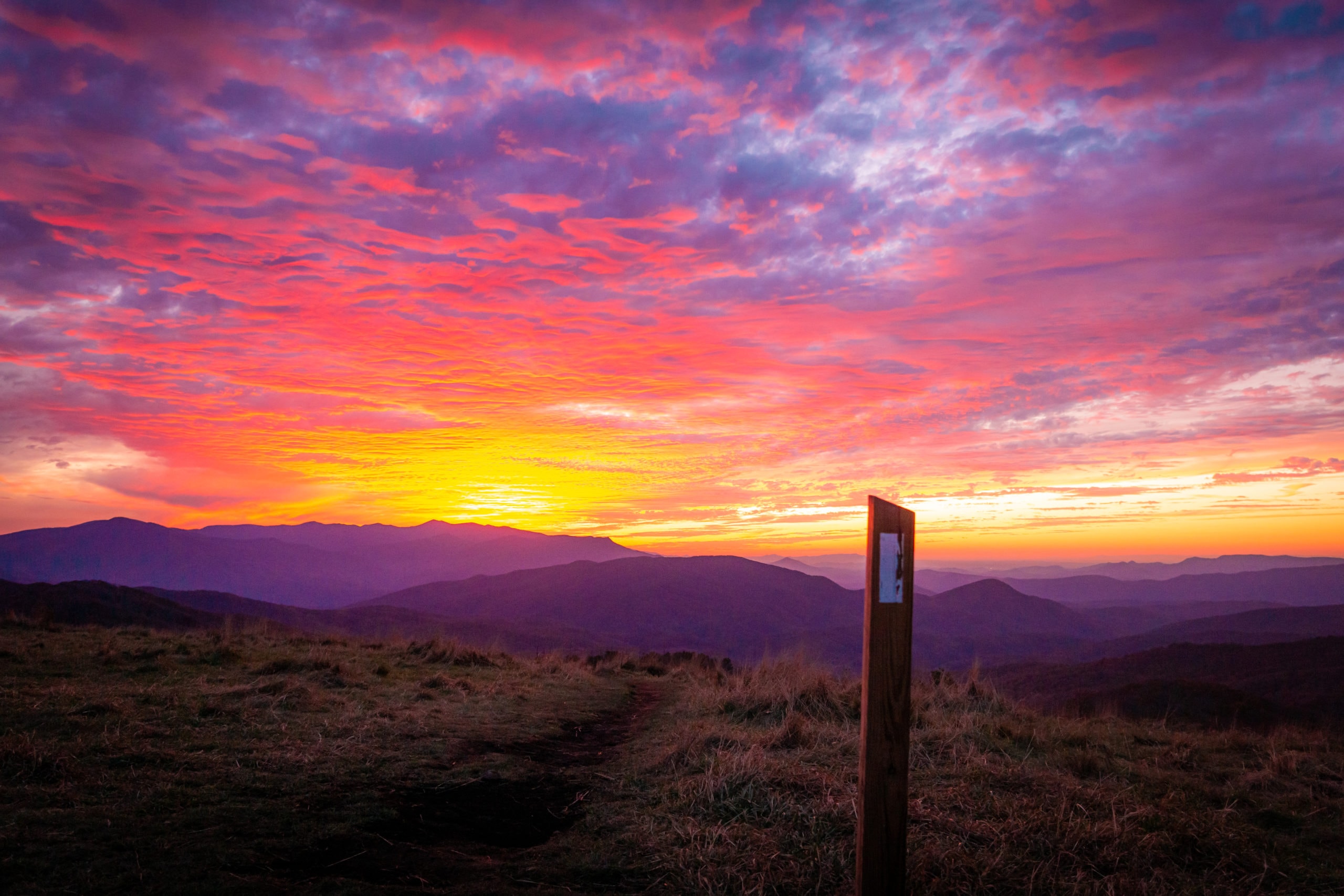
We once again arose and had camped packed up well before the sun, and made a few miles to the little stony man cliffs where we watched the sunrise over Shenandoah. It has been a long time since we have watched a sunrise from a good vantage point, and it was certainly worth while.

With hopes of ending our day at highway 33 over 30 miles south, we only took a few short breaks throughout the day. But the going in the Shenandoah has been smooth and easy despite the climbing. Switchbacks, moderate grades and smooth trails have made all the difference. With this, big mile days have been more attainable and enjoyable in this section. With great views throughout the day, it seemed to be the trail that we had been dreaming about.

After 13 hours of hiking, we arrived at our goal well before the sun began to set. At the highway a couple of friends from the PCT came and picked us up, taking us back to their farm for the night. It was a beautiful farm tucked in at the base of the Shenandoah, and we talked late into the night about their dreams and goals for the land in the future.
The next day, we decided to hang around the farm and lend a hand where we could. We fed and watered the chickens and rabbits, along with the world’s happiest cow – Honey Butter. It was great to jump back into the homelife for a moment, and enjoy the things we’ve had to leave behind.
Unfortunately it was around this time that we really began to evaulate our finances and the feasibility of finishing the trail. We soon came to the realization that finishing may not be a possibility this year, and we began to look into our different options. Thankfully William and Becky let us stay on the farm while we figured this out, and in the meantime were able to continue helping with chores, and moving equipment from the old farm they had just relocated from.
We ended up on the farm for over a week, and in that time we were able to rest our bones while still getting a lot done. Our feet and legs needed the break more than we knew, and as our farm vacation grew longer, our trail family all began to catch up. William and Becky graciously brought them all to the farm as well, and here we had a sweet reunion. It certainly eased the sting of getting off trail, which we were slowly beginning to accept as our reality.

Just as we were parting ways with our trail family, we connected with an old trail friend who learned of our position and offered us their assistance to help us finish. It was a hard thing for our pride to accept, but it certainly beat the alternative.
After countless home cooked meals, waking to the rooster each morning, and eating our body weight in persimmons, we left Natural Roots Farm behind, eager to come back in a few years time to see how it will grow. Will and Becky were truely a blessing, and we enjoyed every minute on their “farm-hostel-agro tourism- retreat,” to be.
With so much time taken off trail, combined with the 50th birthday of a friend from the PCT who was hiking to south, we decided to jump a little ways down to be able to spend Indra’s 50th with her.
We met at the peaks of Otter, better known as POO. There was a very nice lodge here, complete with restaurant and resort, looking out over the lake at hightop mountain. We spent our time here catching up with Indra and her partner Shoki, and continuing our streak of eating very well.

It was clear from the clientele that thru-hikers did not stop at this resort very often, so naturally we stuck out like sore thumbs. Perhaps it was the four or five plates of food we had from the breakfast buffet, or sprawling out on the greens with our ground tarp as a picnic blanket and our sleeping pads as chairs; regardless we certainly got our fair share of strange looks and naieve questions.
It was a relaxing place to catch up on each others adventures, and celebrate a birthday, but it didn’t take long before the desire to pick up the trail lifestyle grew strong. After taking over a week off, we hiked out slow and steady, joined by Indra and Shoki.
After our last breakfast at the restaurant combined with our squeaky joints, our trek up the mountain seemed a bit laborious. As we didn’t start walking till the afternoon, we kept our ambitions modest and only walked about seven miles before setting up at the middle creek campground.
When we arrived, we first thought that we had mistaken this remote campground for a trailer park… Permanent mobile homes lined the dirt road, with not a single tent in sight. After wandering around, we found the remants of some old campsites that they had just finish clear-cutting and called it a day. It certainly wasn’t the nicest campground we’ve ever stayed at, but it was only home for the night.
We left Indra and Shoki the next morning at the campground, knowing we would not see them again on this trail. As they have been hiking the Appalachian trail in sections, they tend to hike fewer miles in the day, and are able to spend more time at the points of interest along the way.
As it turned out, jumping ahead for Indra’s birthday put us in close proxmity to a family run bluegrass and skill share festival known as Mountain Run Jam. We emailed them about the possibility of volunteering in exchange for admittance, and immediately we received warm welcoming messages from the folks in charge. Most all of our trail family got wind of this, and did the same.
Pretty soon word began to spread, and Shoe Goo decided to try his luck at hitching north to join us for the festival. With the thanks of a few local officers, he made the 100 mile trek in good time and surprised us all.

The musicians we saw there were very diverse, ranging from acoustic folk music to club DJ’s. The workshops varied just as much, but were just as interesting. The free form basket weaving and homemade pedal lathe were definitely my favorites, but there was a wealth of information on homesteading skills that surrounded the weekend.
As only a couple hundred people filtered through over the course of a weekend, it was a small event that was very community oriented. Surprisingly, many folks had strong connections back to Michigan, and even had some common acquaintances with Mandalynn. Live music and dancing filled a big void we didn’t know we had, and in the meantime we helped fuel the event with fresh energy. More than a couple of times it was the hikers that got everyone off the ground and dancing to the music…
We got caught in a micro-burst as the festival was winding down on Sunday, and 60 mph gusts flattened nearly every tent. The band had to stop in the middle of their set, as everyone ran for cover and to secure their things. It took four of us to hold the our tarp down and keep it from flying away; but a couple tents that were poorly staked in, got destroyed, and absolutely everything was soaked.
After ten minutes the wind and rain disappeared just as fast as it had come. The band decided to pick up their set off-stage, totally acoustic, giving us an intimate priavte concert by the Gazebo. It was a beautiful way to conclude the weekend, and by the end we had made friends with most everyone in charge.
After cleaning up Monday morning, the folks in charge helped shuttle all eight us back to the trail. We only made it a couple of miles that day, but getting back on trail felt like a success onto itself.
After a much needed night of solid rest, we hit the trail with the intention of hiking big miles. Leaving Matt’s creek shelter behind, we began a long and slow climb that would take most of the day. Eventually we topped out at apple orchard mountain, one of our first 4000ft peaks since Vermont.
Along the way we passed through the infamous guillotine, a precarious rock formation through which the trail passes. As we were running low on water, we did not stay long before continuing our search for a running creek. Despite the deluge we found ourselves in 48 hours earlier, we scoured the creek beds for any remnant puddles and all we found was dust.

At last we found a few small pools near the Cornelius creek shelter, where we took a much needed break and replenished our reserves. Soon we began to feel human again, and we set out for our last five miles to camp. The miles were all downhill and went relatively fast compared to the first half of the day. Unfortunately when we arrived we found another dusty creek, forcing us to re-evaluate our plans for the evening.
After a bit of discussion, we opted to hike off trail back to the middle creek campground, where water, showers, and laundry awaited. It turned out to be one of the best decisions we made all day… After getting cleaned up and making a small fire, we felt like radically different people compared to oursleves early in the day. A needed end to a trying twenty-five mile day.
We enjoyed a bonfire late into the evening, and made no attempts to rise early in the morning. Nonetheless we got out ahead of everyone else that we’ve been hiking with, beginning another long climb that would take us up to cove mountain. We ran into a couple hunting dogs up on the ridgeline, and they followed us for several miles towards the summit before dipping down into one of the hollers. Later we would find out what they were hunting, as several men and the dogs passed by some of our trail family on the road with a black bear atop the truck.
Despite the climbing, the morning miles went quickly, aided by the distraction of the transitioning fall colors. Many of the rhododendrons in particular put on a bright red display that could not be missed. But once again water was scarce, so we had to plan our day around where we might find water. Thankfully we found many creeks with small puddles, and even a large water cache of about 15 gallons. As it was in the 90’s with high humidity, it seemed that we couldn’t drink enough as sweat poured out of us at an ungodly rate.

All afternoon we bounced back and forth between the trail and the parkway which it mirrored. Sometimes walking on the road is a nice break from trail, and in this area, it often comes with better views. Following the crest of the blue ridge mountains, we found many great vistas overlooking the Roanoke valley. But sometime beyond our afternoon break, the trail spit from the parkway for good, leading us downhill to the Wilson creek shelter.
We filled our canteens to the brim in Wilson creek before making our final ascent for the day. With the combination of tiredness, heavy water and a steep grade, the going seemed to take an especially long time.
At last we came to Fullhardt knob shelter perched on the mountain top. With a water catchment built into the roof and piped into a cistern, we were beyond thankful to quench our thirst without restraint.
As the sun set and a sliver of the moon appeared, city lights began to gleam while the frogs lulled us to bed with their nightly chorus. A peaceful resolution to yet another long day.

Knowing we only had five dowhill miles into the town of Daleville, we enjoyed a slow and lazy morning before finally making our way down the mountain. The miles went quickly, but the heat of the day was in full swing before we knew it. By the time we hit the highway we were desperately searching for a refuge with air conditioning.
We found such a refuge in the form of a Taco Bell, where we sat for several hours eating countless burritos and taking advantage of our first wifi in several weeks. Around this time, Mandalynn got in touch with an old friend of hers who lives in the nearby town of Roanoake, and before we knew it, he scooped us up and brought the trail family back his abode.
A beautiful four-story home over a century old, Mandalynn’s friend Collins was kind enough to give us free reign over his kitchen, bathroom and backyard. We made generous use of all of these, and got ourselves smelling like well fed flowers in little time.
As night time began to set in, we headed into downtown Roanoake where we stumbled into a lively karaoke bar called Fork in the Market. However karaoke might be a misleading term here, as every song was enthusiasticly backed up by everyone crammed into that tiny hole in the wall. Before we knew it we had a couple dozen new best friends, that wandered in and out of our night across town. Some time in the early morning we made the trek back to our four-story chateau, where we made a little bonfire before finally falling asleep for good.

Without too much surprise, no one was up early the next morning, but Mandalynn saved the masses with a delicious home cooked breakfast of potatoes, biscuits and eggs. Even with a solid meal in our stomachs, the going was slow and difficult. Like herding a bunch of turtles, it was painful at times trying to get the show back on the road. Finally in the middle of the afternoon, we set out into the unforgiving heat, and made four miles back up into the mountains before calling it a day. It may not have been very far, but at least it was progress.
As we had to make a dry camp, being that there was no nearby water sources, we skipped our hot dinner, coffee and breakfast and opted for easy no-cook snacks instead. While it wasn’t ideal, it allowed us to break camp and get hiking much faster than usual. We departed with the rising sun, though that isn’t saying much as it comes up so late with fall moving in.
For the first time since we first started this trail, we actually had a cold morning, somewhere in the low fifties. As it had been the hottest recorded day of summer just 24 hours earlier, the change couldn’t have been more needed. We set out from our camp taking in the cold air with smiles on our faces. Finally it had begun to feel like fall.

We ridge walked most of the morning, slowly climbing up Tinker mountain before topping out at its picturesque cliffs. As it was a fair weather Saturday and a popular destination, we began to see day hikers and weekend warriors by the dozens.
As we left the Tinker cliffs behind and began our next climb up to the even more popular McAfee’s Knob, the weekend adventurers only thickened around us. By the time we got to this most famous of the knobs, we could hardly get a picture without dozens of fresh smelling city folks getting in the way. Nonetheless we had a pleasant lunch break here, and gave the day hikers a good insight into the life of a thru-hiker.

Coming down the otherside to the parking lot where most of these people had originated from, we were reminded of our trip down the Grand Canyon in April; every ten seconds we were shouting out, “Excuse me, coming through, passing on the right, squeezing by on the left…” etc.. Once we passed the parking lot, the hoards disappeared and we once again had the trail to ourselves.
As we made our final miles of the day into the Four-Pines Hostel, I was fortunate enough to get stung by some flying insect on the back of my knee. At least it helped cover up the pain of the foot injury I had sustained a couple days earlier while helping move some doors in Roanoake. Sometimes a break is hard to catch.
We rolled into hostel around dinner time, and met Joe, the man in charge. He was certainly quite the character, but the hostel was clean and had everything we could have asked for – and for that we were grateful.
As part of a hiker tradition, one whole side of the hostel (a converted garage) was painted with black chalkboard paint, so hikers could sign the wall as they passed through. As it was already quite full when we got there, Joe tasked us with mopping it down to a blank slate, giving us choice opportunity to make our mark.

We made a late departure in the morning, and began climbing up to last of the famous three knobs – Dragon’s Tooth. It was steep and rocky going, some of the most technical trail we had seen since New England. But the tooth was well worth it. Not only was it far less crowded, but the monolithic dagger-like formations begged be climbed from every angle, revealing expansive views of the greater Catabwa valley. We took a long break here, and enjoyed every minute of it. To date, it was one of our favorite spots on trail.

The climb down was a gentle one and went quickly. We opted for a road walk around Bush Mountain as Mandalynn was feeling under the weather, and had been battling a headache for nearly 24 hours. While we were skeptical at first as people in Daleville had warned us about this area, we were offered water and multiple rides within ten minutes of walking down the road. It was a pleasant walk through the country, mostly old cattle farms and homesteads. Everybody waved as we passed by, and by the time we got back to the official trail, we decided that these were some of the nicest folks we had met in this state.
We set up camp on Craig’s creek, where there were half dozen foot bridges but only a couple pools of water. I suppose it is hard to be picky this time of year, but a tall bridge over a dry creek is all too reminiscent of the Southern Arizona desert from which we came. At least it has begun to feel like fall…
The next day only had three climbs, but each were commendable. Our first climb out of camp brought us up to the Eastern divide. As we neared the top we came upon what appeared to be a dead bear in the trail. After making a ruckus, it slowly awoke and began stumbling around; it was hard to watch, but it seemed to have a broken leg. When we finally got service up on the ridge line we called it into Game & Fish and hoped for the best.

We enjoyed a long ridge walk along the divide, passing through old apple orchards and stone silos. As we began to drop off the ridge, the trail turned due North down to the highway. As we neared the road, wandering through cow pastures, we passed by the second largest tree on the Appalachian trail – the Keffer Oak. Big trees have always been of interest to us, and this one was no exception.

We took a short break by the road before taking off on our second climb, slightly longer and steeper than the first. When we reached the top we were treated to a good view from Kelly’s Knob, a rocky out cropping near the summit. Once again as we departed, the trail took us due North down to the next road crossing. It seems that it has been days since we’ve actually hiked South, our trajectory primarily being Westernly, with these sporadic detours to the North sprinkled in.
When we got down to the forest road, we were greeted with trail magic from Wags parents (Wags being one of our thru-hiking companions). Bringing cold drinks, water, chips, salsa and VEGAN pizza, we were beside ourselves. So often we have watched others enjoy trail magic in the form of pizza, but this was the first time we could join in.
After sharing the magic with several other hikers, we parted ways with Doug and Dana, and began our third and final climb. As it was the largest climb of the day, our pizza laden stomachs did not make the going any easier. Luckily the trail was well graded though, allowing us to keep a consistent pace.

As we neared the top we could tell that rain was coming. We optimistically kept hiking, wishing that it would hold out till we made our camp, but didn’t get that lucky; about a mile and half away it began to rain, at which point we ran the remaining distance. Nothing like running your last mile into camp in the rain after a twenty-five mile day….
We setup hastily in our attempts to keep our gear dry, and while it would have been a dry camp, we were at least able to collect several liters of water in our cooking pot as it ran off our tarp. After several months of dry skies, a good rain was more than needed, providing a nice silver lining to the evening.
The rain came down through the night, with no sign of letting up when we slowly arose in the morning. After consulting the maps, we decided to take our chances and push on to the next shelter, where we could more comfortably wait out the rest of the storm.
We packed up our camp beneath the tarp, leaving the shelter for last. Once we had everything else ready to go, we put on our wet clothes, took down the tarp and immediately began walking in order to stay warm.
Unfortunately the trail through here was one of the worst sections we had seen in a long time, thick with over grown thistles and abundant rocks. Despite our eagerness to run down to the shelter, keeping an even pace without slipping on the wet rocks seemed to be an impossibility; and even then, Mandalynn took a hard fall on her knee. But to stop moving in the rain felt like a sudden death, and we pushed on. By late morning we arrived at the Bailey Gap shelter, and soon began stripping off the wet clothes for the dry wool ones that lay burried deep in our packs.
We spent the rest of the day there, slowly collecting other soggy hikers as they passed through. By nightfall six of us lined the floor, and a dozen more had passed on to shelters further down the trail – the most hikers we had seen in a day since passing the North-bound bubble in New England. As the light faded and night began to fall, the rain finally began to taper off, rekindling our hopes that clear skies were soon to follow.
By morning the skies were still grey, but it seemed that we had seen the last of the rain. We put on our freezing wet clothes once more, and prayed that in the absence of rain, our body heat would dry them out as we walked.

We opted to take the back roads over the trail, primarily because of Mandalynn’s injured knee, and secondly because it is much easier to stay dry when compared to the wet understory of the trail. For several miles we walked on the road, following Old Stoney Creek. Eventually we turned off onto a dirt road that took us up into the hills, and as we pressed on, the condition of the road only deteriorated.
Just as we were starting to question whether the road would cross over the mountains to the New River basin, we began to see some old homesteads once more, and evidence of road maintenance began to reappear. Before long we were walking on blacktop again, headed back to the trail. We had to walk the train tracks along the river for last mile, but it was a pleasant end to our alternate route. We soon rejoined the trail crossing over New River and quickly found ourselves in town of Pearisburg.
We spent the night at the Angel’s Rest hostel, where we made a huge taco bar with Smudge and Scavenger. After a dozen tacos I had to throw in the towel, a genuine feeling of fullness in our stomachs.

Tenting in the yard at the hostel, we awoke in the middle of the night to something rustling around our tarp. As we instinctively shot up out of a dead sleep to see what it was, we were less than excited to see the unmistakable black and white markings of a skunk.
Quickly weighing our options, we made our presence known as gently as we could, making quiet coughing noises. Thankfully the skunk got the hint and meandered into the bushes without spraying us or any of our gear. Nonetheless we slept poorly the rest of the night as we remained vigilant for his return.
In the morning, we got our things together and re-evaluated our resources for the remainder of the trail. As we really started to consider the miles we had left with respect to our remaining funds, the realization that we may not make it to Georgia began to set in, and put a heavy damper on the morning. The more we talked about it, the more it seemed that we ought to plan on ending our hike early before exhausting what resources we had left.
It put us both in a depressing state, unsure of how we should best move forward. As we were hoping to wait for the rest of our trail family to catch up, we couldn’t afford another night at the hostel, forcing us to move on without them.
To further compound our state of affairs, there was another hostel, a little further south, that we had heard about before we had even started in Maine. It was called Woods Hole Hostel, and we had heard so much about it – and were really looking forward to a stay there, but this now seemed to be an impossibility. But as we talked with the folks at Angel’s Rest, they encouraged us to call the proprietor of Woods Hole and see about a work-for-stay arrangement.
After a bit of hesitation, we took their advice, and nearly came to tears at the kindness we found on the other end of the phone. Neville invited us to Woods Hole with open arms, and promised a means of making our time there worth while.
As we packed our bags and readied for departure, she called us back and informed us that she was coming into town, and if we would like, she could slack pack us into her hostel. With a big climb to get out of town, this sounded like music to our ears. We left the majority of our gear and food behind, and raced up to the top of the mountain. Even without the burden of our packs, we were still out of breath and dripping with sweat when we got there, but taking a break seemed unnecessary, and we continued on down the ridgeline.
The remaining miles into Woods Hole went quickly, and by early evening we wandered into the picturesque homestead. Early pioneer cabins from the 1800’s spotted the property, while pigs, goats, and dogs all roamed around freely.

We were given the nickel tour by one of Neville’s helping hands, named Golden, and then washed up in time to help with dinner. Homemade pizza, egg salad, bread and garden fresh salad all came together for one of the best home-cooked meals we’ve had on trail. We enjoyed dinner with Neville, sharing genuine reflections on life and the trail well into the evening. After a couple rounds of tea and banana-grams to wrap up the night, we went to bed with a feeling of satisfaction that we hadn’t felt in a long time.

We spent the next couple days felling, bucking, chopping and stacking enough firewood to get Neville through the winter. While it has always been one of my favorite chores, it felt great to use the upper body for a change. In exchange for the wood, Neville continued to supply us with an endless amount of incredible food, and gave us a space in her pellet-stove heated 1840’s bunkhouse.

Our time there raised our spirits immensely, and we left that place with a changed attitude as we looked to the future. As Neville put it, “Life has more glory than a plan.”
We followed the old Appalachian trail out of the hostel, taking us by a decomposing shelter, where several people were murdered in the 70’s. The route was considerably shorter than the official trail, and compensated for our late afternoon departure. We connected this into a dirt woods road that followed Dismal Creek, paralleling the trail to the East.
We were a little caught off gaurd by the large Amish family that came rolling down the road in a horse and buggy. We exchanged pleasantries, but didn’t want to stare too much; after they passed we turned to get a better look, and found them all doing the same back in our direction – an interesting glimpse into another way of life.
Soon after, we took our afternoon break at The Falls of Dismal. Despite the name and the minmal amount of water, the falls were still quite beautiful, and offered a relaxing spot to rest.

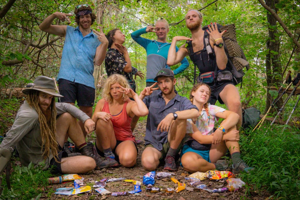
As we began to wrap up our day, we stumbled into some trail magic put on by fellow thru-hikers Naille and Legacy. We spent the night carving pumpkins, sharing stories, and catching up with the rest of our trail family that we hadn’t seen in a few days.
We made a late getaway in the morning, walked a mile in the wrong direction, got saved by a local angel, and didn’t really get moving down the trail till noon.With a package waiting for us in the town of Bland, we only hiked a couple of miles before we stopped at a road crossing. Here we could easily hitch into town in the morning, collect our package and get back hiking South. While the rest of our family could have hiked on, we vortexed them into camping by the road with us, enjoying a Monday afternoon as best as one can.

The morning was one of the coldest we’ve had on trail, just a few degrees above freezing. Most everyone we were camped with was so cold by morning, that they packed up there things at the crack of dawn and began hiking to stay warm.
Being quite comfortable, we decidedly slept in much later than the rest, and only got up once the ambient temperature rose a little. We walked down the road with Disco for fifteen or twenty minutes before a car finally passed us by. The Jeep window rolled down and a soft spoken man asked where we were going. He said he’d be happy to give us a ride, but he had to drop his dog off first, and then he could come back for us.
Sure enough “PacMan” reappeared ten minutes later, and brought us to the Bland post office. A real angel, he gave us his number and said to call when we were ready to get back on trail. After securing our resupply and getting some fresh town food, PacMan came back and scooped us right up. We tried to offer him a little compensation for his time and gas, but he humbly refused all payment before sending us on our way.
We made a big push that afternoon to make 15 miles by nightfall, landing us in the town of Atkins. With significant wind and rain over the next 24 hours, we split a small motel room amongst four hikers seeking shelter from the storm.
Our timing worked out great as the storm bellowed through the early hours of the morning and well into the next day. As it let up a little in the afternoon, we left the motel and made it a couple miles down the trail to a historic school house left open to hikers. We took refuge here as the wind and misty rain picked up later in the day, grateful for a roof and four walls.

The wind continued into the following day, but blue skies amongst the racing clouds promised that the rain had passed. We left the shelter of the old school house wearing all of our layers; a true rarity for us. The cold wind bit our faces as we made a slow and gradual climb up to Glade mountain, just above 4000ft.
When we got up to highway 62, we caught a ride with a local bow hunter down into the town of Marion. We made a quick resupply at the local grocery, before catching some interesting hitches back up to the trail. As the sun began to set and the temperature started to plummet, we hastily looked for a place to lay our heads.
We found a piece of flat and dry ground just off a closed section of trail, and quickly made camp along with some hot food to warm our freezing hands.
We were on the edge of being uncomfortably cold the whole night through, the body heat of another human being the saving grace. These days it has been hard to get an early start, as the sun doesn’t come up until after 7:00, and the freezing darkness keeps us confined to our sleeping bags.
From camp, we began a climb up to one of our highest altitudes in all of Virgina – The Grayson Highlands. As we made our approach, the fall colors put on a magnificent show of oranges, reds and yellows, verigated with the fading greens of the stubborn maples. Perhaps it was the increase in elevation, or the recent rains, that brought on this picturesque change, but it was one of the best color displays we have seen to date.

As we got up 4000ft and began a series of long ridge walks, the high alpine environment afforded us some of the best mountain views we have seen since Vermont and New Hampshire, some thousand miles to the North. Stretching our eyes never felt so good, and by the time we reached camp, everyone had a smile on their face as they recollected the beauty of the day.
As if the highlands weren’t impressive enough, they also feature a population of wild ponies. We bumped into them throughout the day, providing a unique addition to the trip. It was clear that they were familiar and comfortable with hikers, posing for photos amidst the high planes.

We spent the night in the Thomas Knob shelter, our first time camping above 5000ft on the Appalachian Trail. Needless to say it was another freezing night. Without much thought, we left our trekking poles and a few pieces of gear outside the shelter as we slept, and were awoken in the early morning hours to three ponies tromping around, chewing on our gear in their desperation for salt. As least they continued to pose for photos when we got up in the morning….

Our climb out of the Highlands was just as beautiful as our entry, but eventually we dropped back into the green tunnel, leaving our expansive views and dramatic visibility behind.
By afternoon the skies were beginning to turn, with a gloomy drizzle on the horizon. We opted to follow the Virginia Creeper Trail into the town of Damascus, an old railroad grade turned bike-path. As it was the season for “Leaf-Peepers,” the trail was overrun with tourists out on their weekend ride. Nonetheless the smooth and easy grade made for quick miles into town, and once the rain found us, the bike path became all but deserted.
We spent the night at a church hostel in Damascus, the same town we visited in May for the famous Trail Days. There were very few hikers there this time around, putting a very different spin on the whole town. As Wags celebrated her birthday here, we struggled to find a place to sleep inside and celebrate – everything was booked up by leaf-peepers.
Thankfully we finally found a cottage at crazy Larry’s, and the whole trail family piled in. Larry turned out to be a true trail angel, someone who had a genuine passion for helping hikers. Over the course of a couple days, we spent several hours listening to his life story; how after spending most of his life in prison, he found the Appalachian trail and discovered a community that was worth living for. His drive to give back and pay forward what was given to him was truly inspiring.
Crazy Larry’s stories aside, the cottage ended up being a great spot for the birthday celebrations. With a kitchen at our disposal, we cooked several feasts that will long be remembered. To top it off, we even made a couple of pies in honor of Wags.
Of course when it came time to check out, the rain began pouring down, stifling any ambitions we had of making big miles. After leaving the cottage behind for the shelter of the Damascus library, we waited out the rain for a couple more hours before getting back to the trail. Over the course of an hour, blue skies began to emerge and the rain clouds disappeared. A beautiful afternoon filled with crisp fall colors took us all by surprise. Enamored with the change, the Virginia – Tennessee border snuck right up. After a long and dry month of 550 miles, we walked into Tennessee with open arms and excitement in our eyes.

We don’t know how much further our journey will lead us, but an end point is slowly becoming tangible. Every day we spend out here is a blessing and an adventure, but the desire to let the roots grow gets stronger just the same. Virginia has certainly been an emotional rollercoaster, but we’ve come out with a greater understanding of why we’re out here. Everything in due time…
Cheers from the trail
Stump and Mandalynn

